About Lake Superior
We’ve been spending a lot of time on the shores of Lake Superior and have begun to understand just what a treasure it is. The largest of the Great Lakes by both surface area and volume with a maximum depth of 1,332 feet, it is also the deepest. On average, a drop of rain that flows into the lake takes about 191 years to flow out. There are about 200 rivers that feed the lake and we think everyone of them has a waterfall! But the most amazing fact to us is it contains more than ten percent of all the fresh water in the WORLD!
Beyond the dry statistics, it is beautiful and incredibly varied in that beauty. While much of its shores are relatively flat, we’re now working our way along the lake’s northern shore in Ontario. Here we’re in mountains and much of the shoreline consists of rugged rock outcroppings. This stretch is very sparsely populated. Most of the tiny towns were established when the railroads were constructed as part of their infrastructure. Even though their role in infrastructure is diminished, they have found other means to survive. Some are quite charming. Others are clearly struggling.
We also should mention that the main road we’re traveling along the lake’s northern shore is the Trans-Canada Highway, also designated on the map as ON-17. Stretching for about 4,860 miles through all ten Canadian provinces, it is actually multiple highways that, together, are designated as the Trans-Canada Highway.
2025-07-28 – Rainbow Falls Provincial Park
Leaving Sleeping Giant, we stopped at the Amethyst Shop on the way to the main highway. This area is known for its amethyst mines. The shop has its own mine and sells its own products as well as other amethysts from around the world. The mines are pit type mines and at least one of them allows people sort out their own examples from the pit.
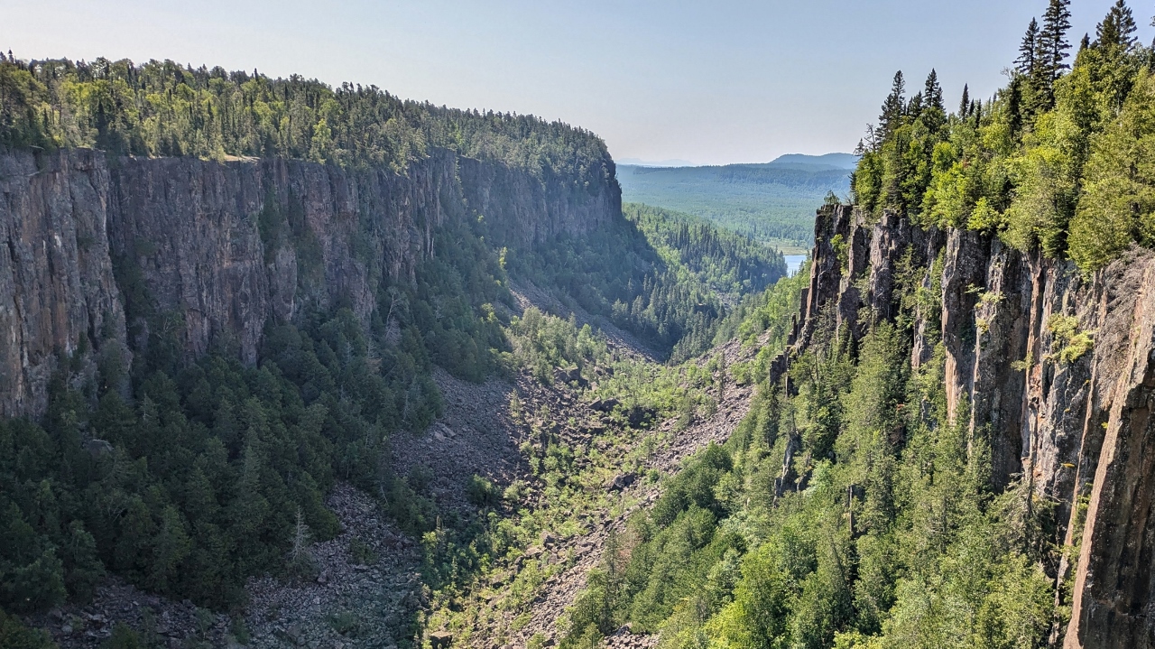
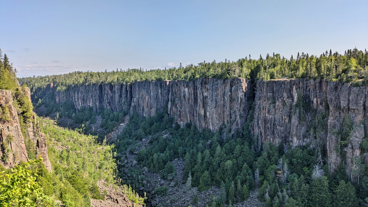
Ouimet Canyon Provincial Park is a rather simple little park with a spectacular view. A short walk on a boardwalk brings you to a viewing platform at the top of a straight-walled gorge that is 150 meters wide and 100 meters straight down to the bottom. Although you can’t get to the canyon floor, it is said its unique environment at the bottom supports plants that otherwise can only be found 600 miles to the north.
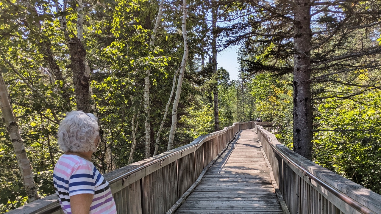
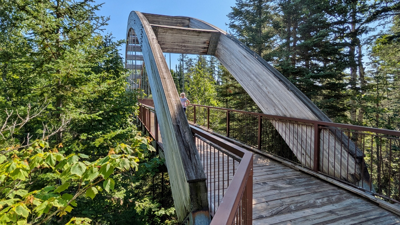
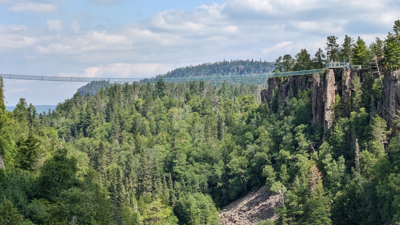
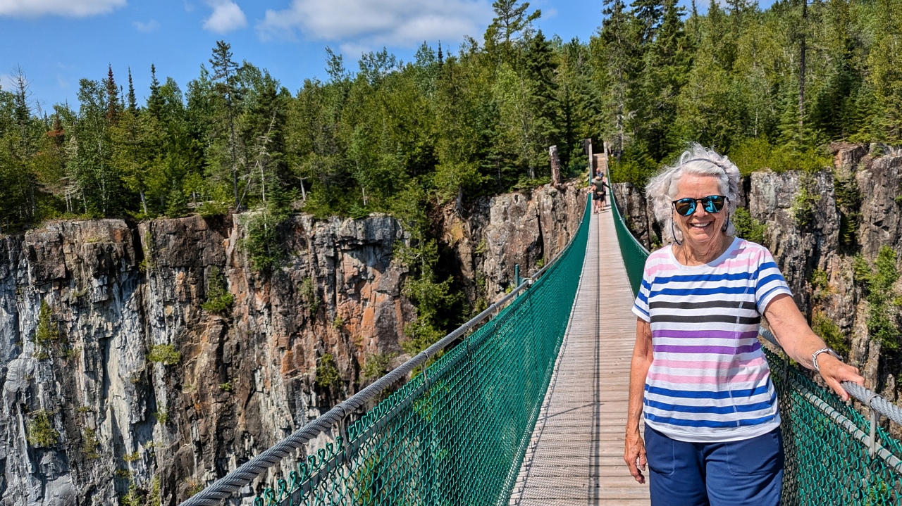
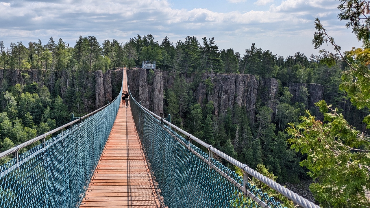
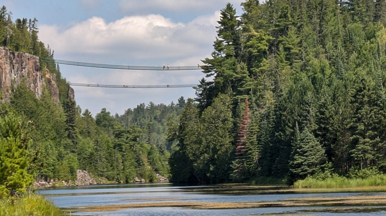
Nearby, Eagle Canyon Adventures is a commercial venture sited at another canyon. They feature a couple of suspension footbridges. The small one is 300 feet long and the other, Canada’s longest, is 600 feet long and 152 feet above the canyon floor! The bridges serve no purpose other than providing a thrill to those who choose to pay the fee to walk them. Sandy was the thrill seeker; Bill read a thrilling book.
20250728_162502302 View of the Long Bridge from a Distance

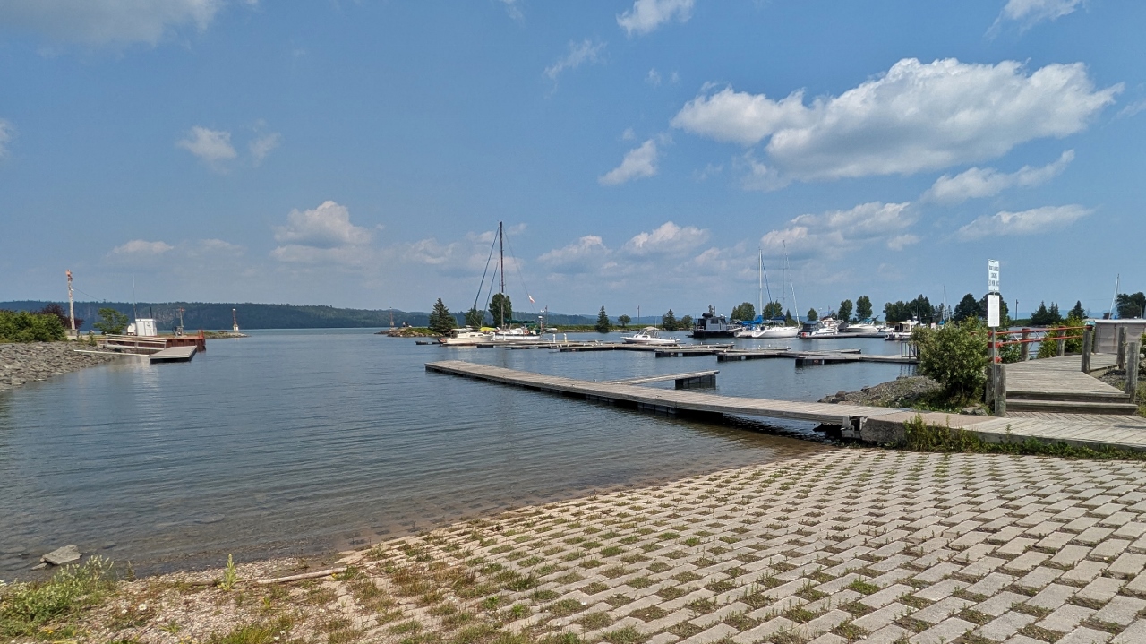
We arrived at one of Rainbow Falls’ two campgrounds, this one directly on the lake shore. We had to make two sequential reservations because no sites were available for two nights in a row. No problem, though, it’s a nice place and it’s easy for us to move.
Dinner was sautéed shrimp with a garden salad.
2025-07-29 – Rainbow Falls Provincial Park
Rossport, just a couple of miles away, was touted as having a charming downtown area. We drove there and, indeed, it does have a smattering of shops but they were all closed on this particular day. Like a number of the small towns along Lake Superior’s north shore, it is struggling. This town, in particular, has a vivid history as a fur trading stop and, in the early 1900s, as a commercial and recreational fishing center. Now, however, the population continues to diminish with a current population of only about sixty souls.
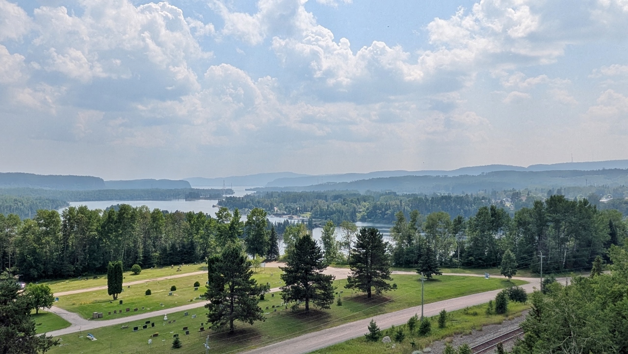
Red Rock sits at the mouth of the Nipigon River. It has variously served as a fur trading outpost, logging center, prisoner of war camp and paper manufacturing center. The Nipigon was considered “un-drivable” for logging because of its drop of 250 feet in just 25 miles until 1900 when James Whalen completed the first drive. The town’s visitor center boasts of the straw bale insulation that fills its sixteen inch thick walls. This area, known for timber products, is now commonly using “green” straw insulated timber frame construction for a number of its public buildings.
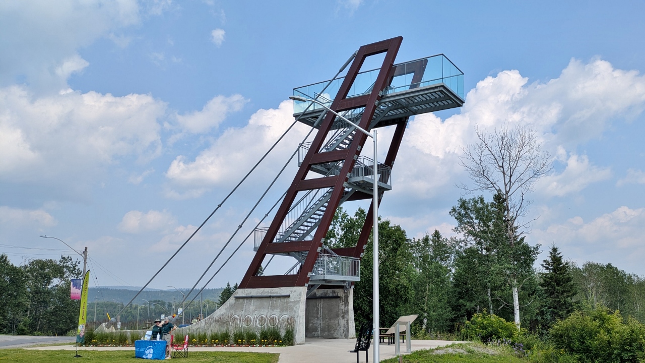
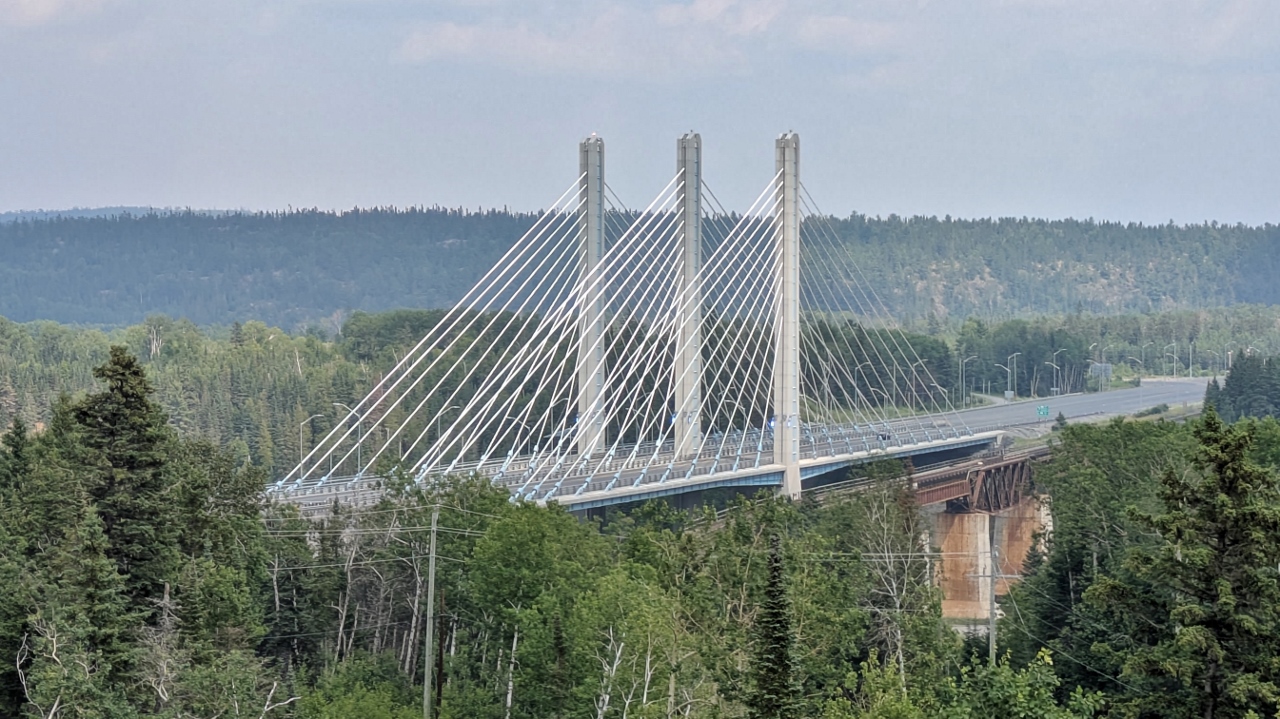
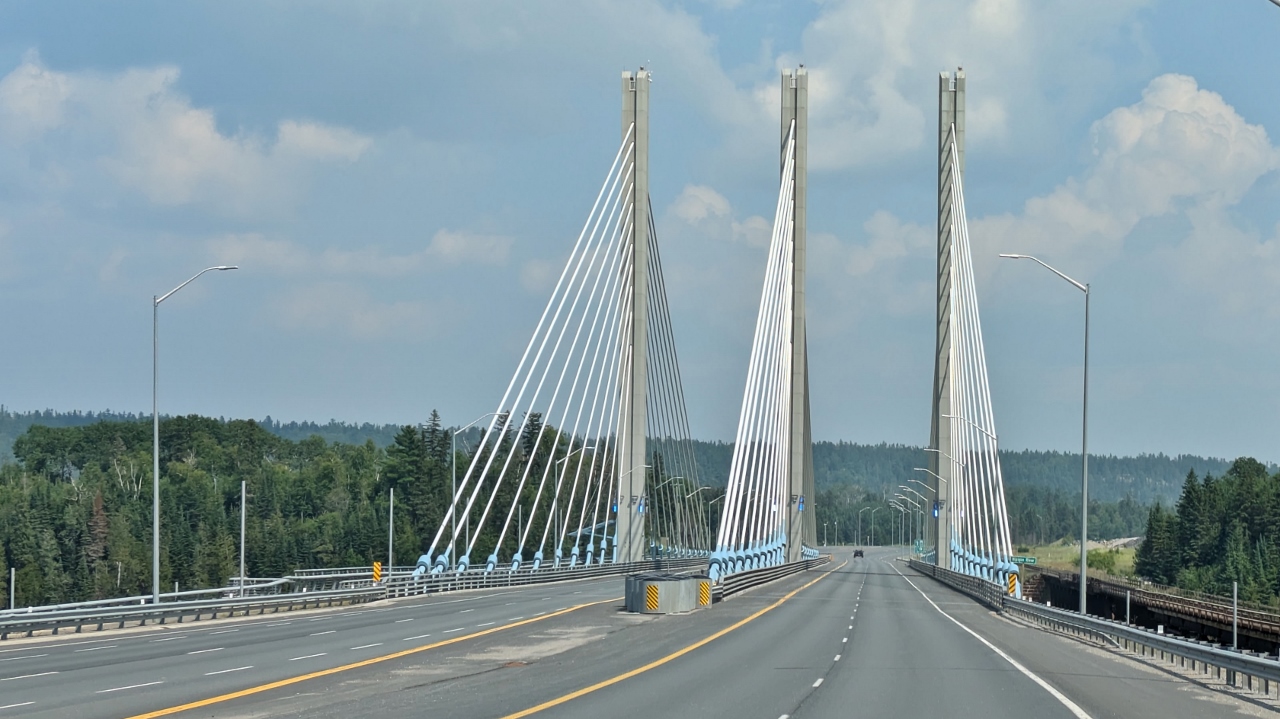
Every river needs a bridge and the Nipigon River has an exceptional one near its mouth. It is a cable-stayed bridge with two spans that was part of Canada’s project to widen its Trans-Canada Highway to four lanes. Problems in both design and construction caused the bridge to be closed temporarily in 2016 when critical bolts failed after a major winter storm. Because the bridge is a single point of failure in Canada’s National Highway System, its closure required vehicles travelling between eastern and western Canada to detour through the United States.
There is an overlook for those who want to see the bridge and river from above and we stopped. It is actually a 40 foot viewing tower that you climb. Interestingly, the main structure of the tower is laminated wood. Pretty neat!
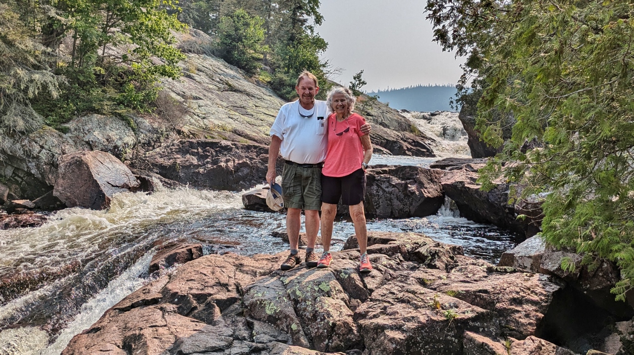
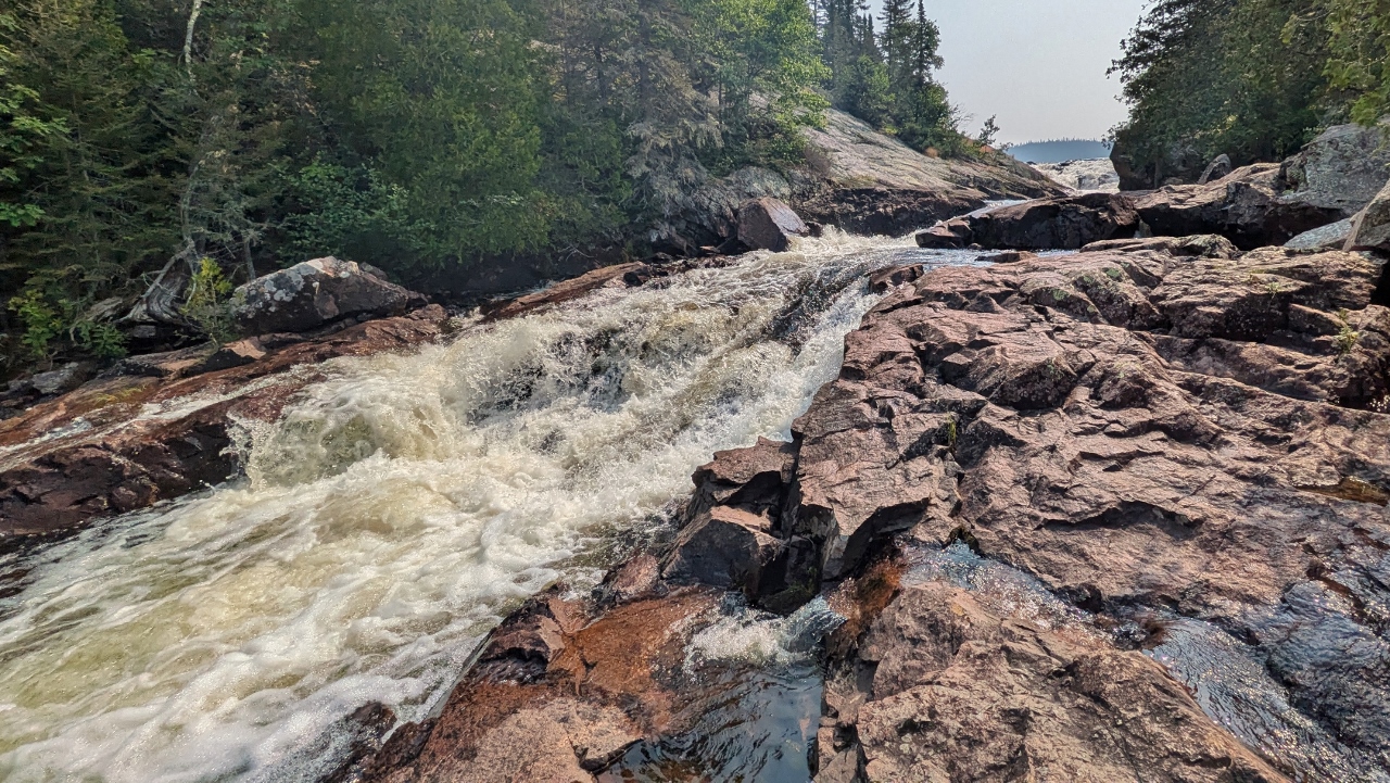
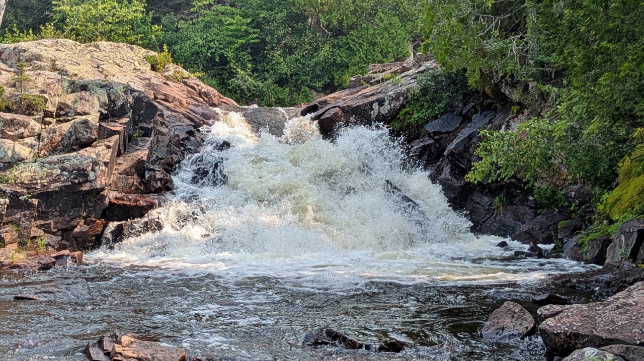
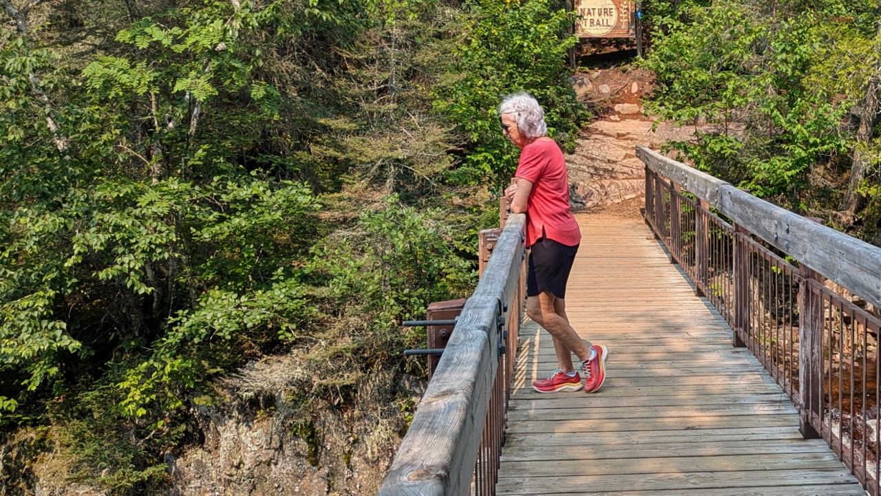
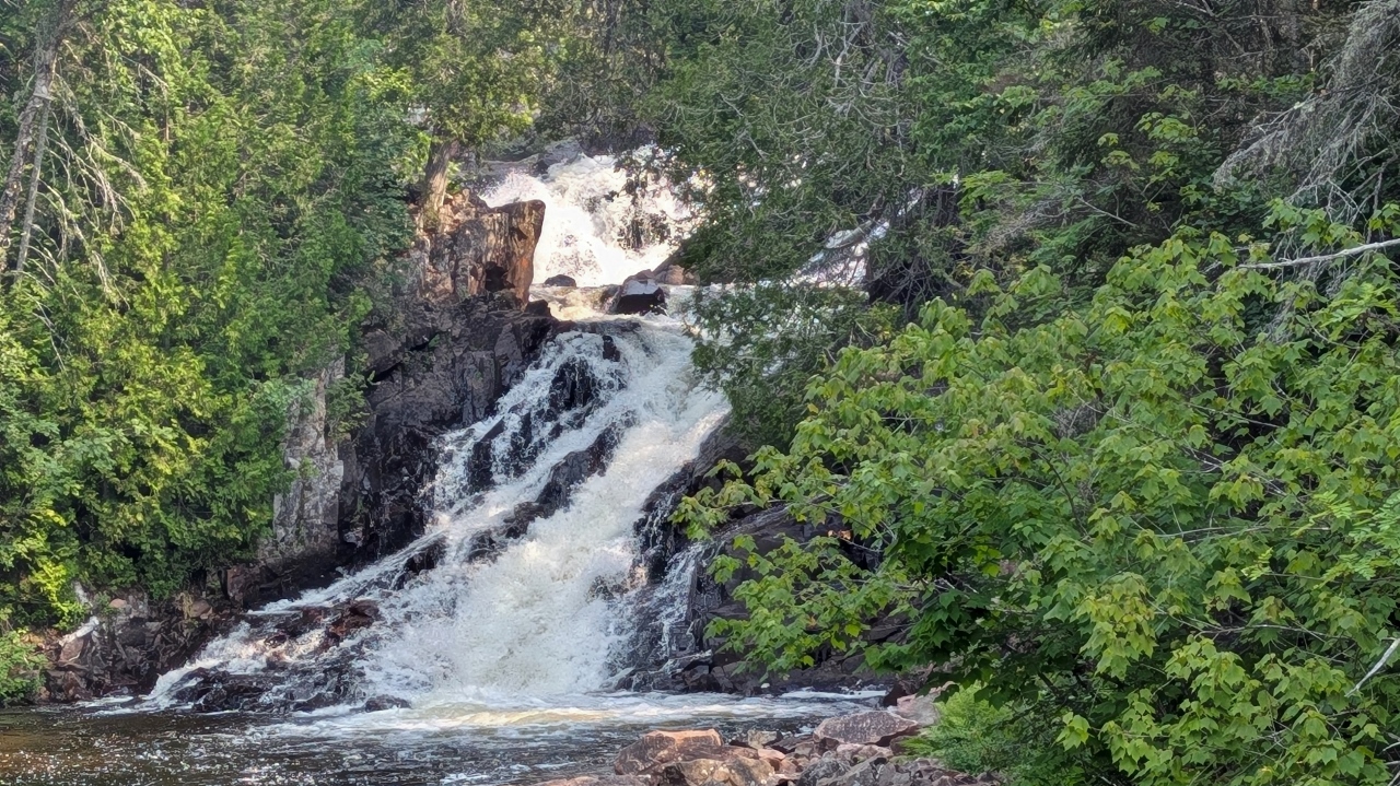
There is an obvious reason why the provincial park where we’re camped is named Rainbow Falls and we went to see them. I say “them” because there is a sequence of five large cascades that make up the falls. They surge downhill, of course, and the trail that leads to the multiple viewing areas is basically all stairs, 180 of them! But the views were worth every step! They were lovely.

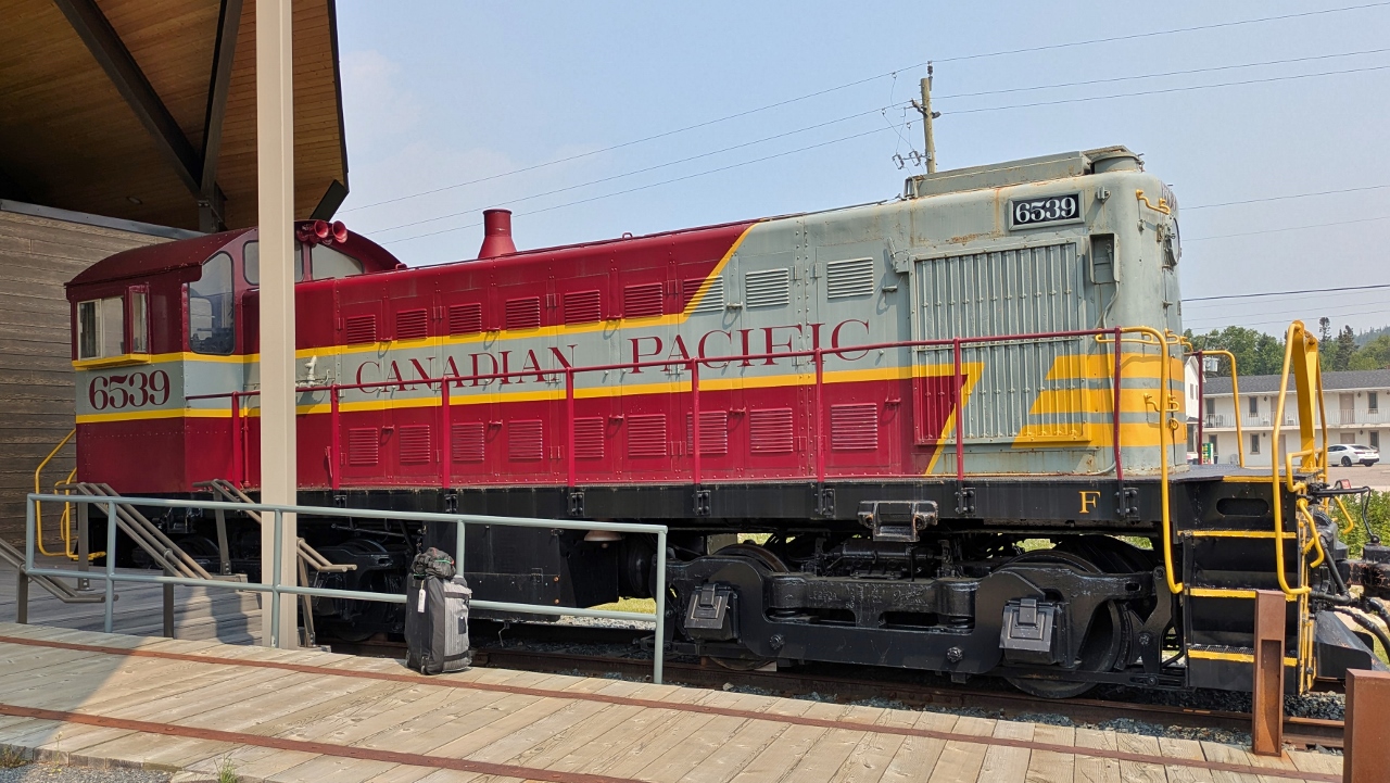
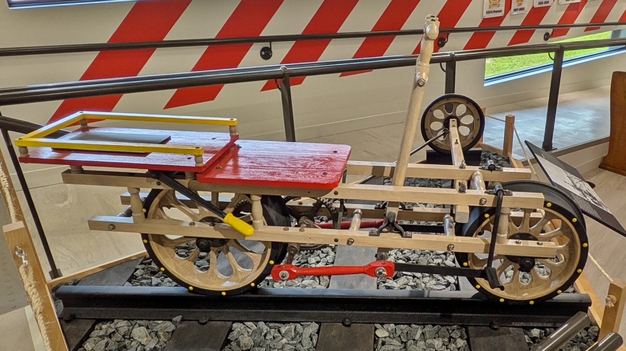
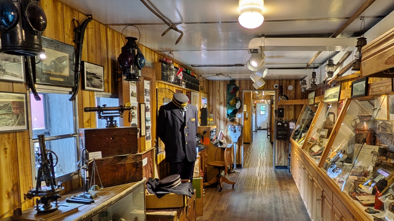
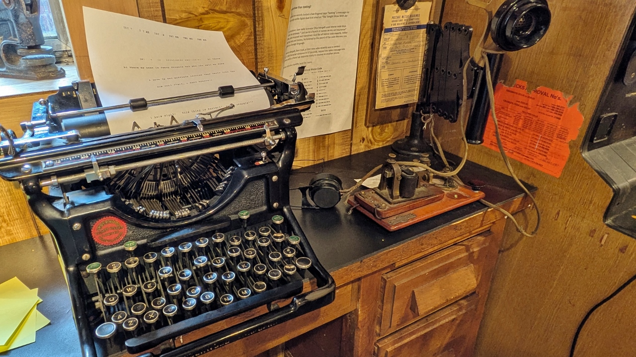
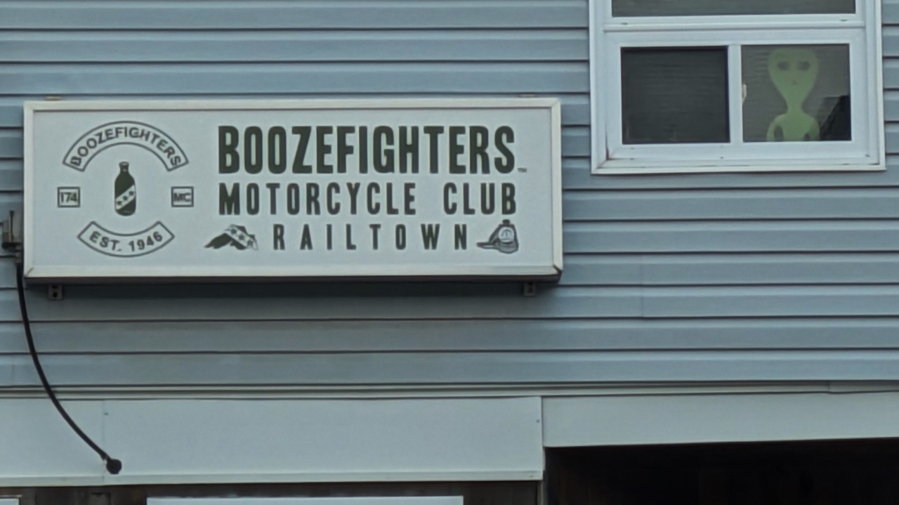
As North Shore towns go, Schreiber has a more prosperous story. The town was founded in 1883 as a construction camp for the Canadian Pacific Railway (CPR). The builders needed materials and ships loaded with those materials could dock at a landing on a beach below the town. The settlement eventually grew from a construction camp to an important railway stop with a station, roundhouse, car shops, icehouse and stock yard soon following. Along the way it was also the location of a work camp established for Japanese-Canadian internees during World War II. A large number of other immigrants also moved to the area including many from Italy. They mostly found jobs with the railroad.
Today, the town continues to serve as a place where trains change crews and many crew personnel now live in the town. They support a library that was having a book sale where Bill was able to replenish his supply. The town also recently updated its Discovery Center, a museum that tells the town’s story with both artifacts and an excellent film. The center’s main display buildings are actually railroad boxcars.
20250729_164935777 Railroading Is Theme at Schreiber Visitor Center
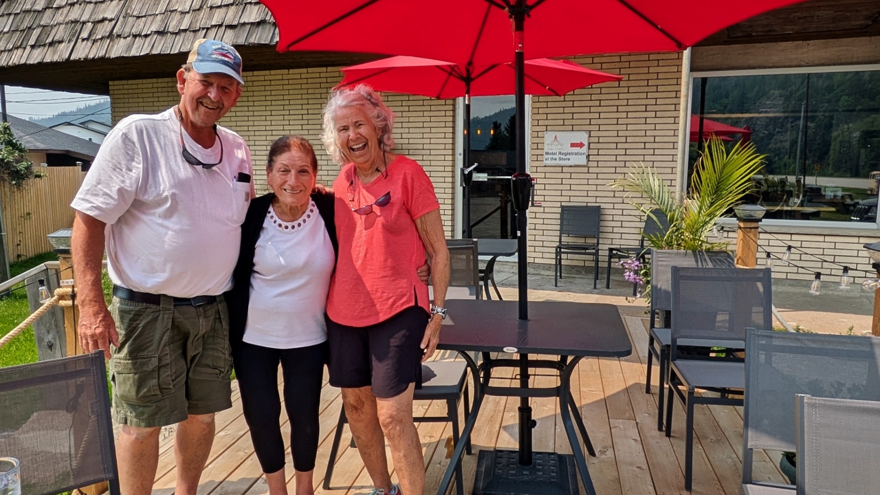
We wanted something to eat and Rosie and Josie’s restaurant was recommended by docents at the Discovery Center. The place turned out to be a full blown Italian restaurant. They offered some gluten free offerings so we ordered a cauliflower crust pizza to share and went out to their patio to eat. On the patio was a woman looking over the potted plants. She turned out to be Josie, the owner. While disease limited her mobility, it didn’t affect her spirit. Italian as they come, Josie was a trip with lots of laughs and stories to tell.
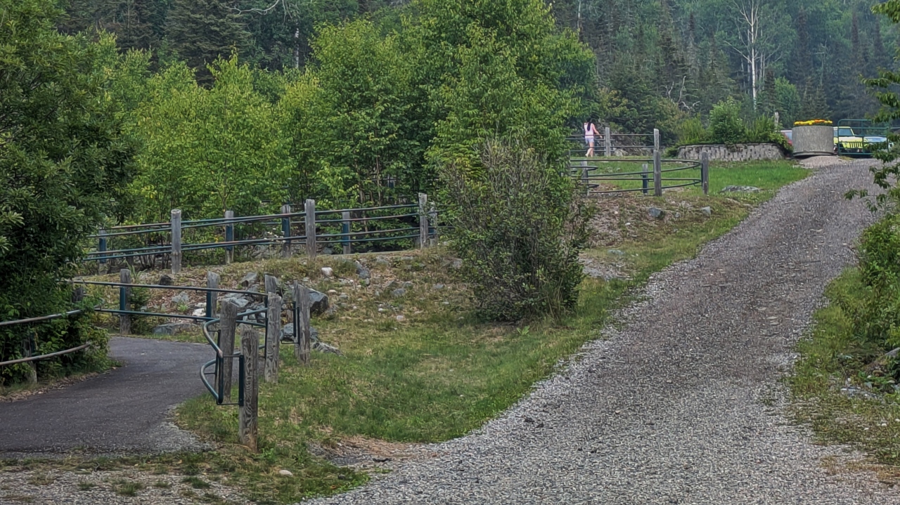
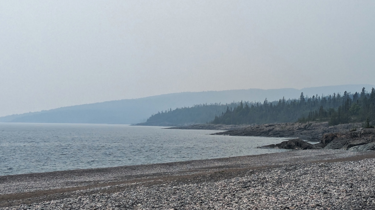
Next stop was the town’s beach. It was a steep drive down to a parking lot and another steep walk down to the beach proper. Like so many public places, this one, too, made excellent provisions for people with disabilities. There was a smoothly paved, switchback walking path that lead down to the beach. It’s a nice, pebble beach and the view would have been prettier were it not for the smoke.
There are a lot of fires in northern and western Canada and smoke from them has arrived here. The haze obscures all of the long distance views, many of which would have been spectacular. So far we aren’t noticing much odor and it hasn’t bothered our eyes. Hopefully that remains the case and the smoke diminishes.
And, finally, friends had kidded us about whether the Canadians would even allow us to cross into the country. They did, of course. But the nicer finding is just how friendly everyone is. Time and time again we’re told how happy people are to have us visiting. And it’s not just us. The people here are simply more outgoing than we’ve typically experienced back in the states. The local shops hand you a “thank you card for visiting us” after a purchase!!
Burgers with avocado, corn on the cob and sliced avocado were on the menu for dinner. We have been delighted that the corn has been very good!