2025-07-24 – Thunder Bay, ON
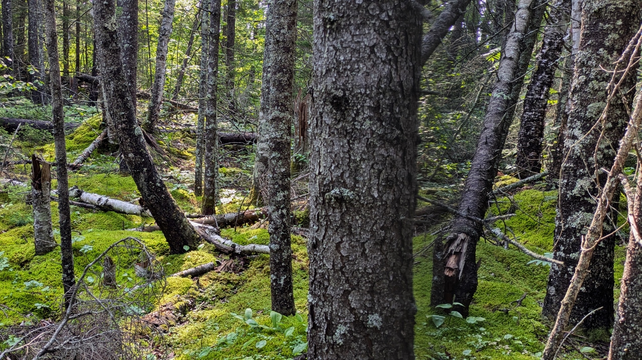
It’s interesting how a 1½ hour drive can stretch to nearly 8. Our drive would simply take us the rest of the way up Minnesota’s north coast of Lake Superior, across the border into Canada and on to Thunder Bay, ON. But there were a few diversions.
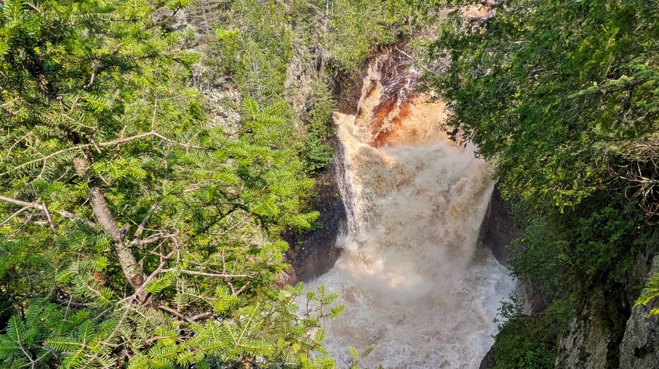
The Devil’s Kettle Falls in Judge CR Magney State Park was our first stop. Just a mile, the sign said, to a unique waterfall that splits above its main cascade and dumps much of its flow into a hole beside the cascade, never to be seen again! Intriguing! The trail began with a bridge across the Brule River and it was immediately apparent that the three inches of rain we experienced yesterday had swollen the river considerably and that the falls would be especially spectacular.
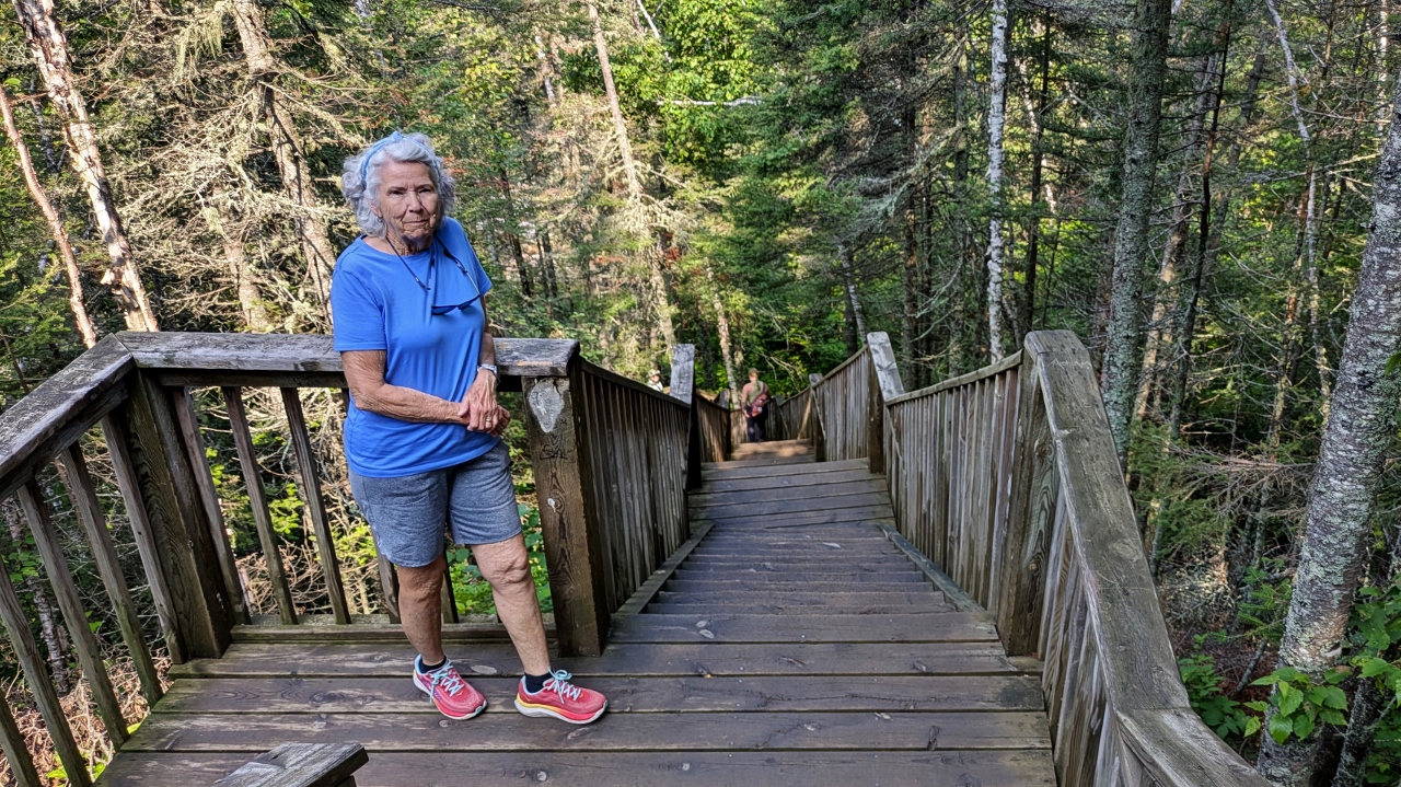
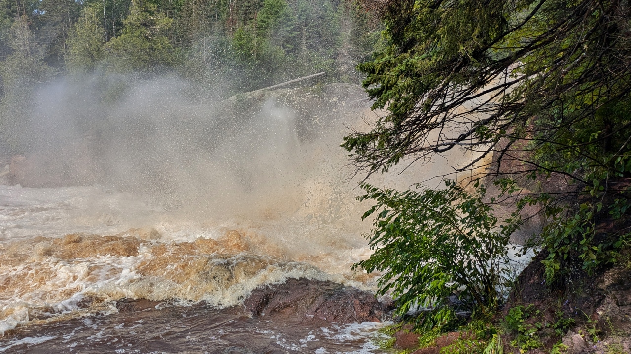
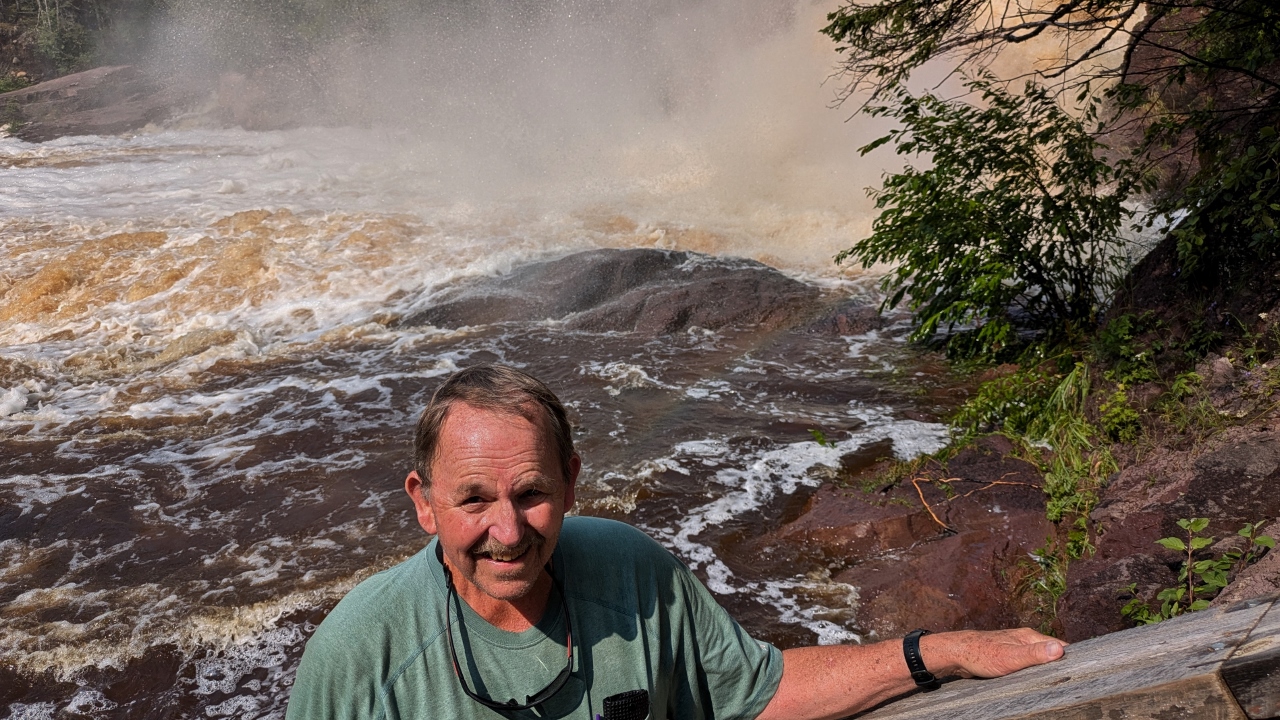
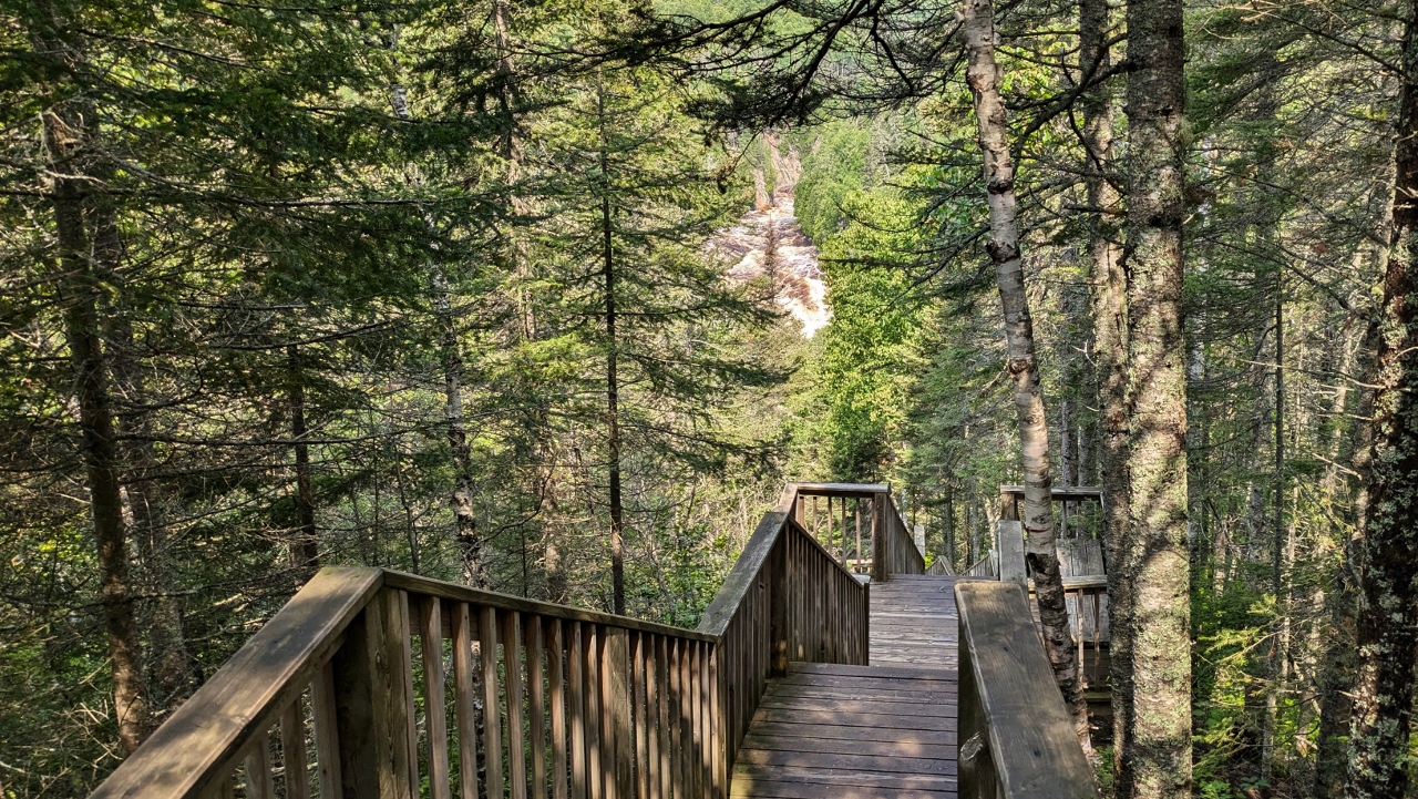
Well, never mind the fact that the one mile trek to the falls was actually a mile and a half. And never mind the fact that there were 250 stair steps each way to get the attention of Bill’s knees. But Bill stopped complaining when we got to the base of the falls. It was spectacular! Continuing to the view from the top of the falls, we kept looking for the split in the falls where part of it dropped into the devil’s kettle. Turns out it was not to be seen that day because it was obscured by the heavy flow. That was a minor disappointment, though. And Bill’s knees will likely recover.
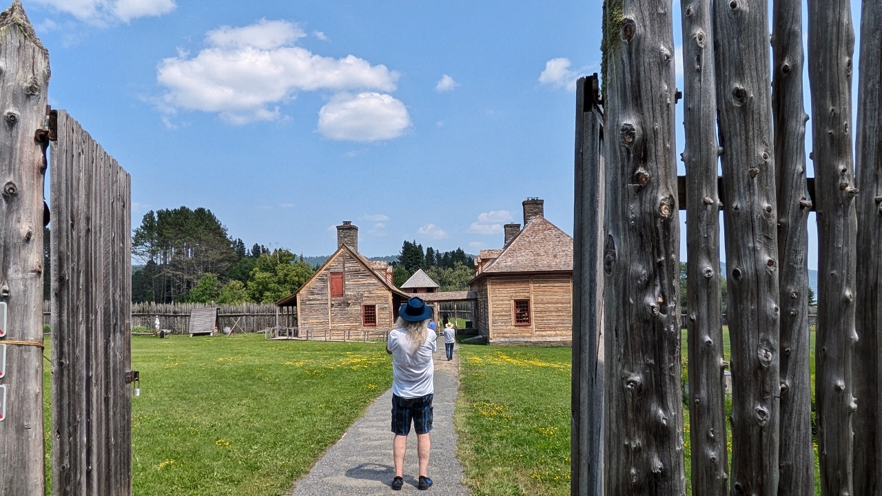
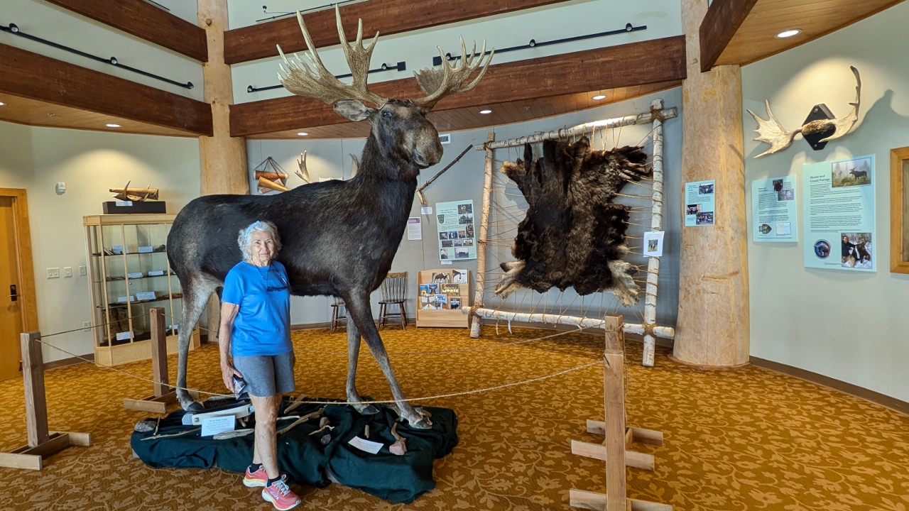
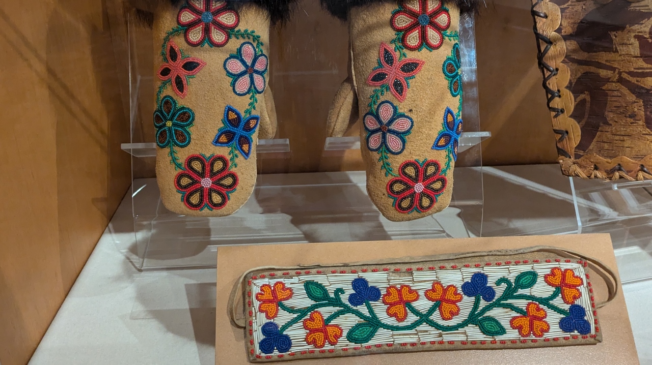
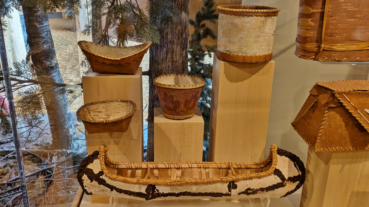
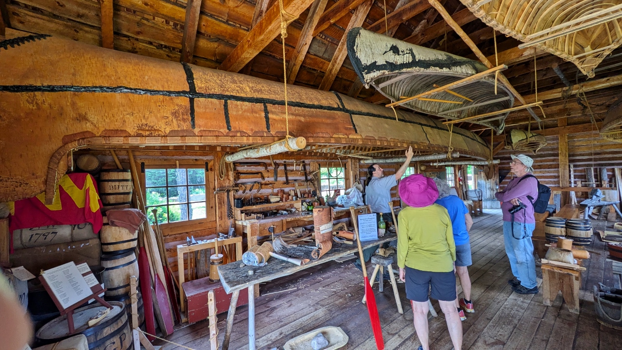
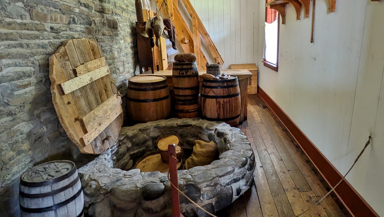
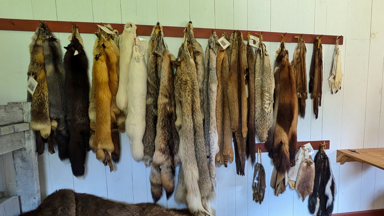
It was unclear to us what our next stop, The Grand Portage National Monument, was going to be about. It turns out that it is a joint venture between the National Park Service and the Grand Portage Band of Lake Superior Chippewa. The monument celebrates the history around the Grand Portage and the relationship between European fur traders and the Native Americans in the area.
The fur trade needed to move pelts from where beavers and other fur bearing animals were found to ships bound for Europe. In the 1780s, the North West Company made this particular area the worlds main distribution hub for the important fur trade. The western end of Lake Superior was roughly half way between the areas where the animals were trapped and where the pelts could be loaded onto ships bound for Europe. It was also the location of a huge waterfall on the Pigeon River around which the pelts and other trade goods had to be hand carried, or “portaged” for about twenty miles.
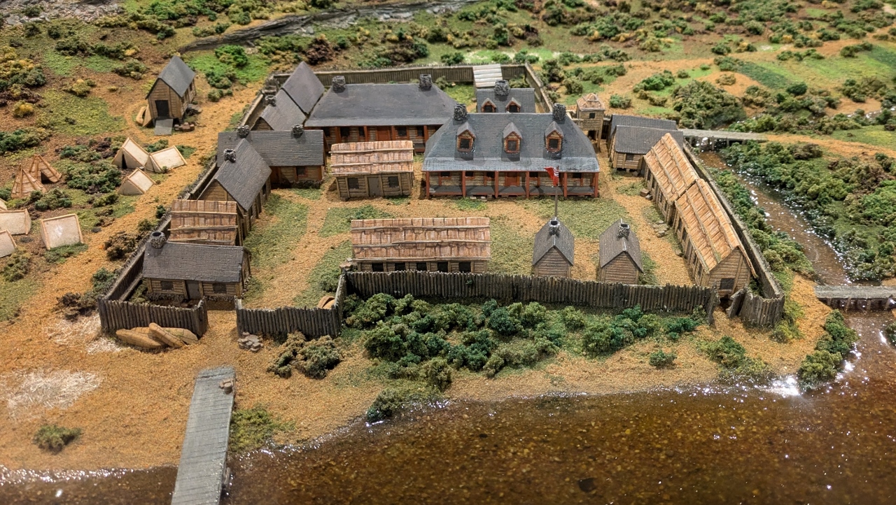
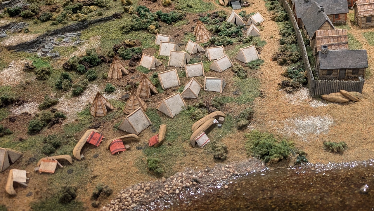
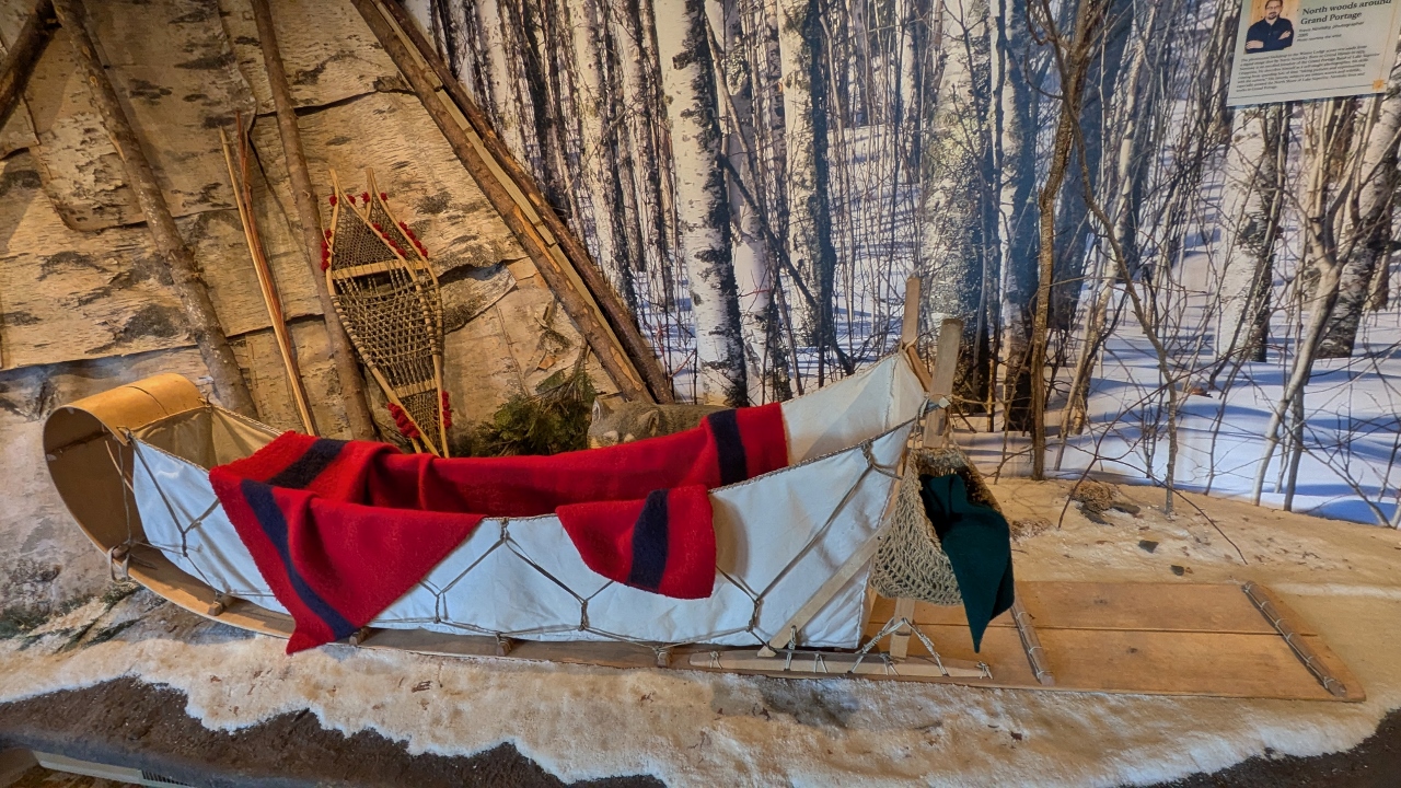
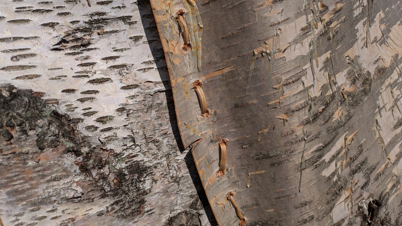
Trappers traded their furs to any of about 100 or so local trading posts scattered throughout what is now southern Canada and the Boundary Waters areas. In turn the furs were loaded into very large, birch bark canoes and transported to the top of the Grand Portage. After carrying the furs down the portage trail they were traded for other goods with the North West Company merchants. The furs were then loaded into even larger canoes, up to about 35 feet long, and transported across the Great Lakes to the Ottawa area where they were loaded onto ships bound for Europe.
The season during which canoes could reliably make the trip between Ottawa and Grand Portage was only about three months long and the trip one way took almost half that time. So it was in mid-July that all the trade business had to occur at Grand Portage. It was a great gathering and time for celebration before all the participants had to begin their return journeys.
The visitor center showed an excellent film about the relationships among the Chippewa, the land and the French who owned the North West Trading Company. It also detailed how those relationships changed as a formal border was established between the US and Canada and, ultimately how fashions changed and the demand for fur diminished.
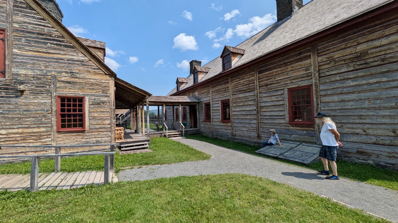
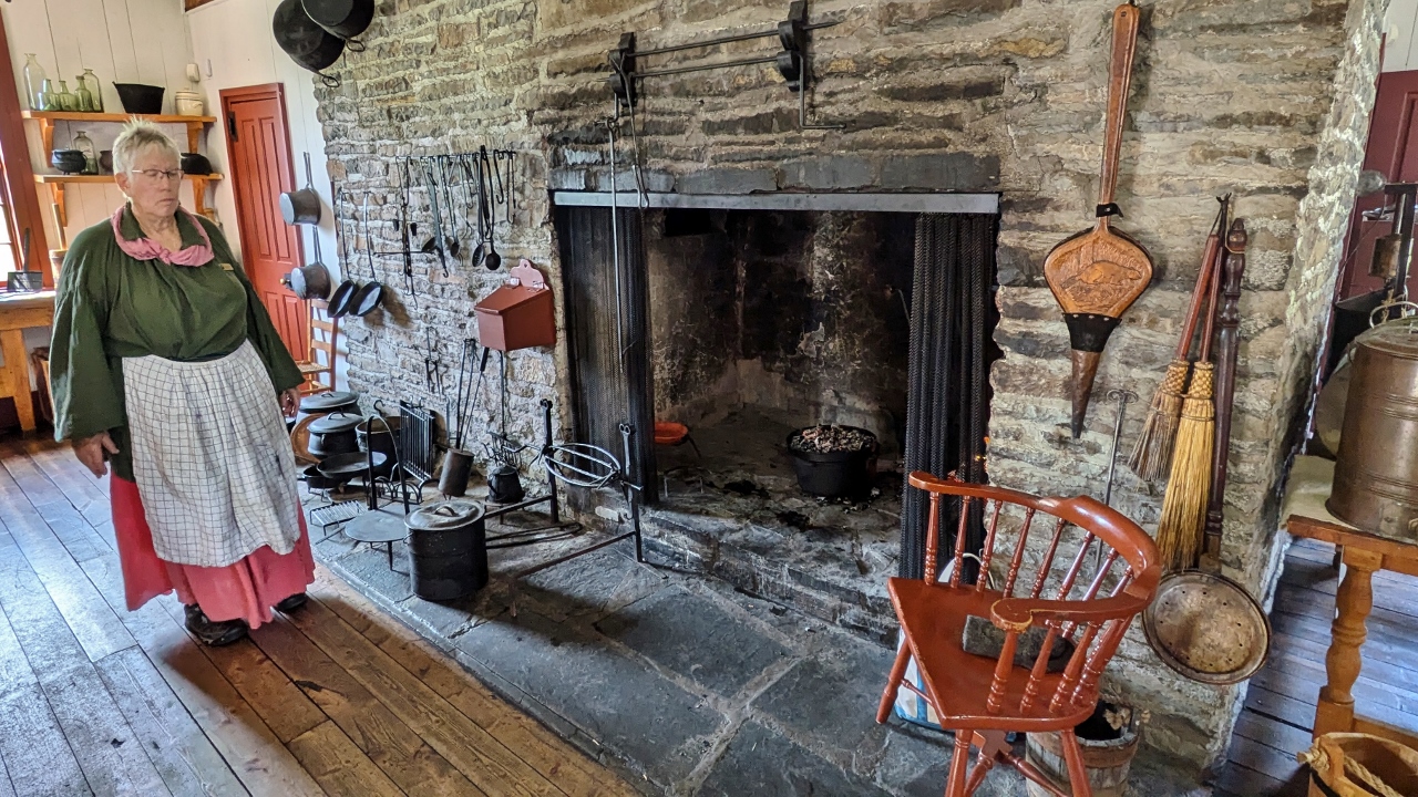
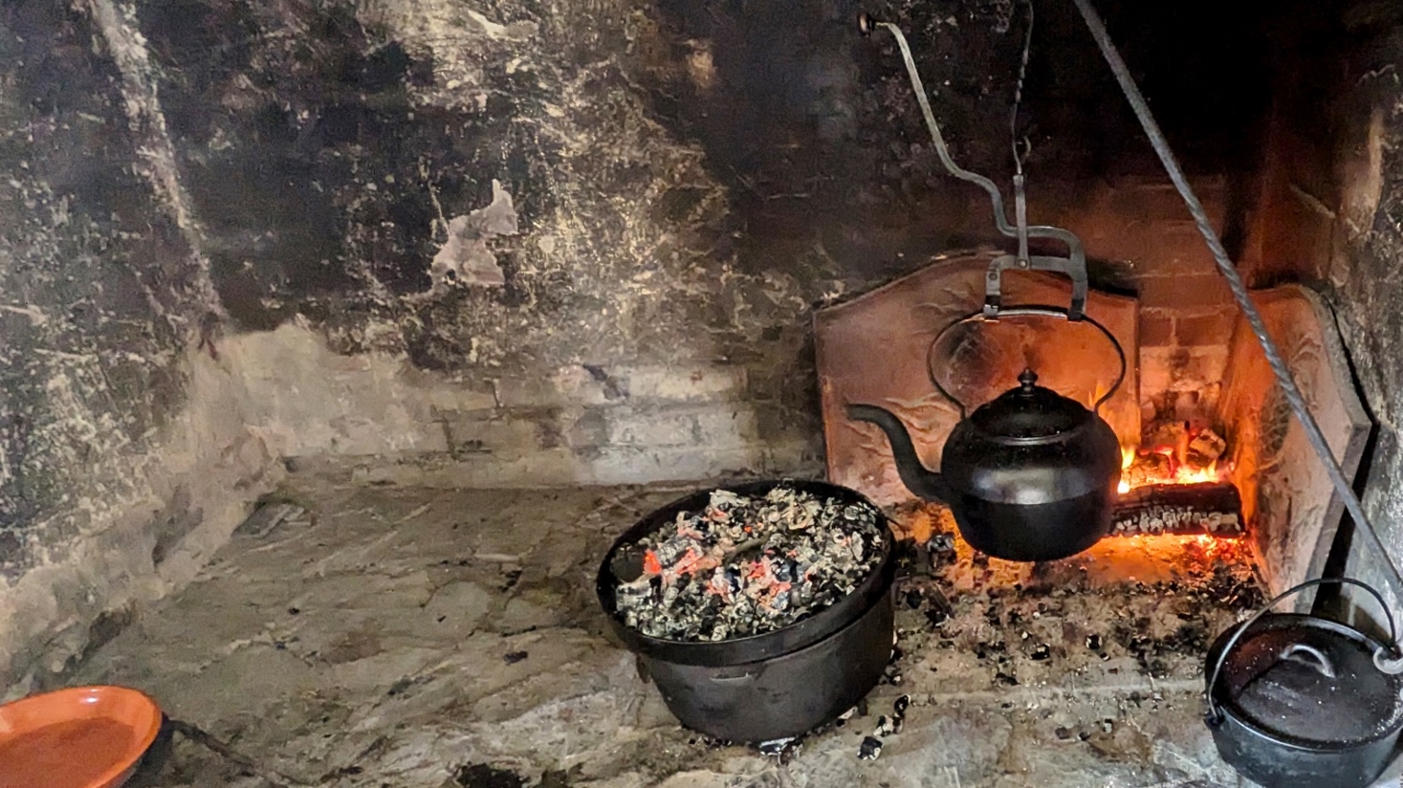
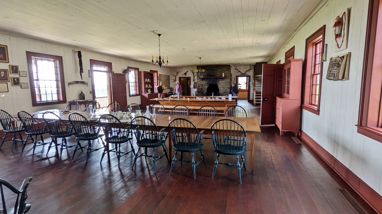
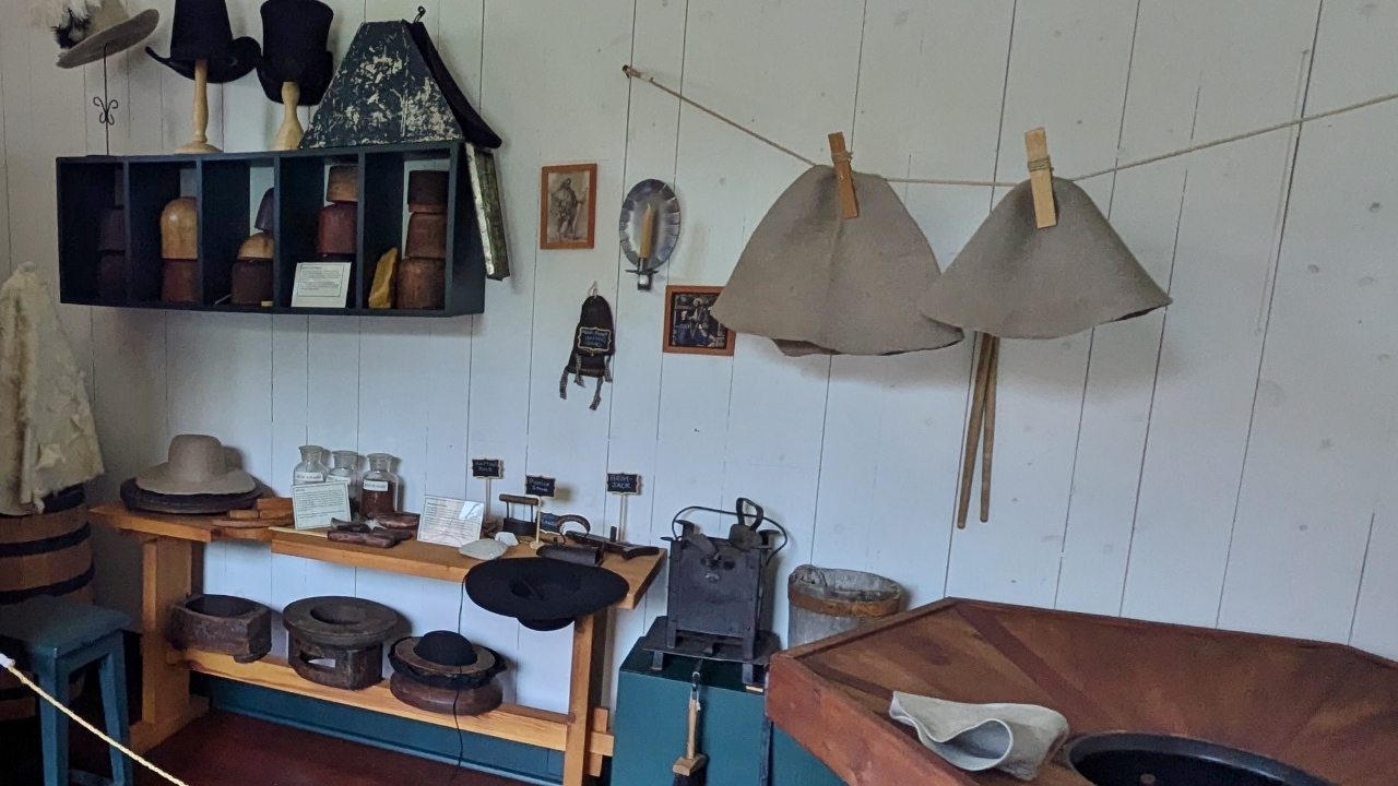
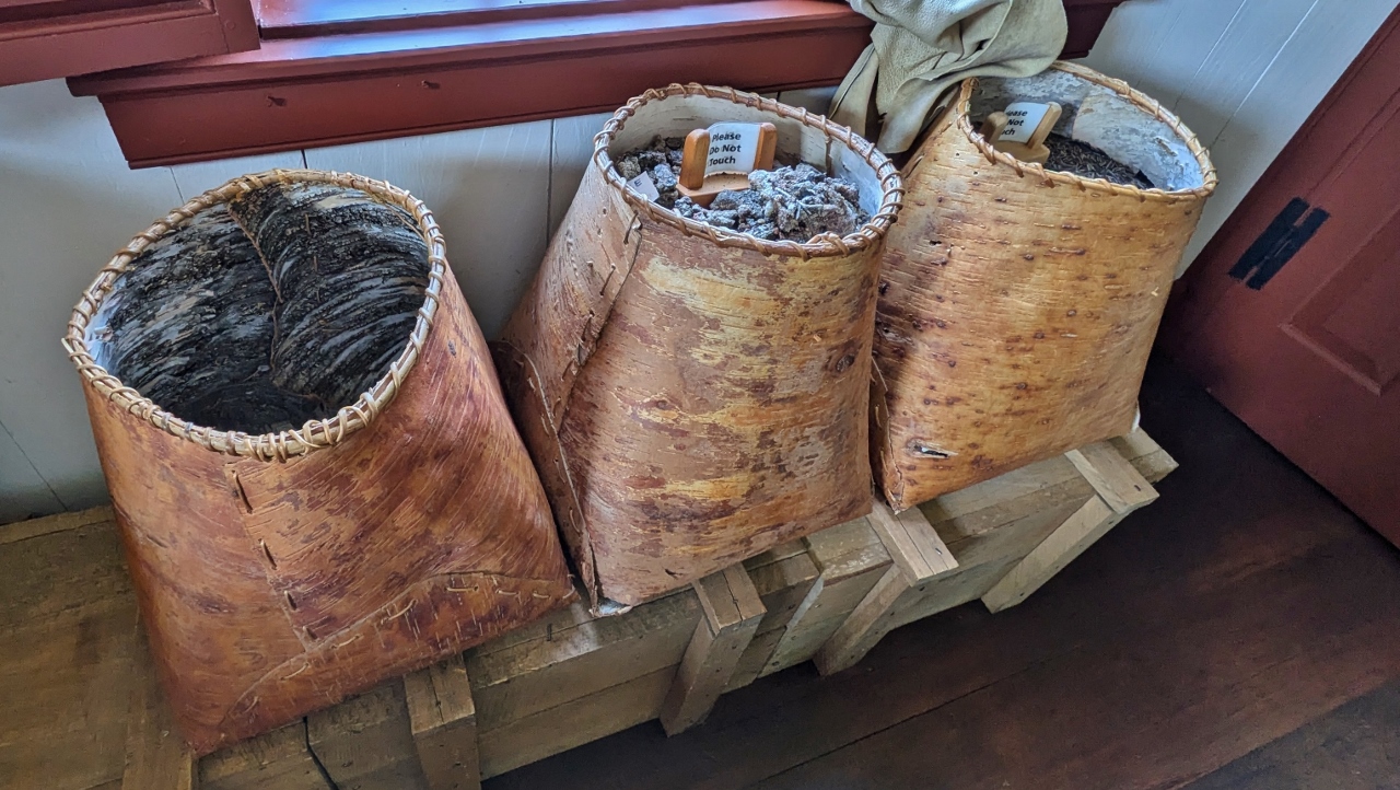
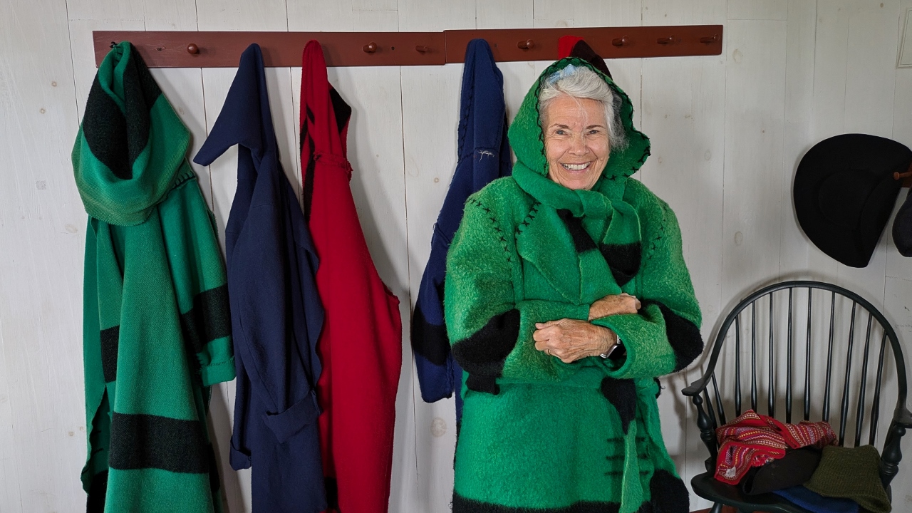
A large replica village was created on the original trading location. It includes typical Chippewa birch bark sheathed dwellings as well as a large stockade enclosure complete with the main buildings which were there. It is staffed by very knowledgeable, re-enactor type docents who answered all the many questions we had. The monument is well worth a thoughtful visit.
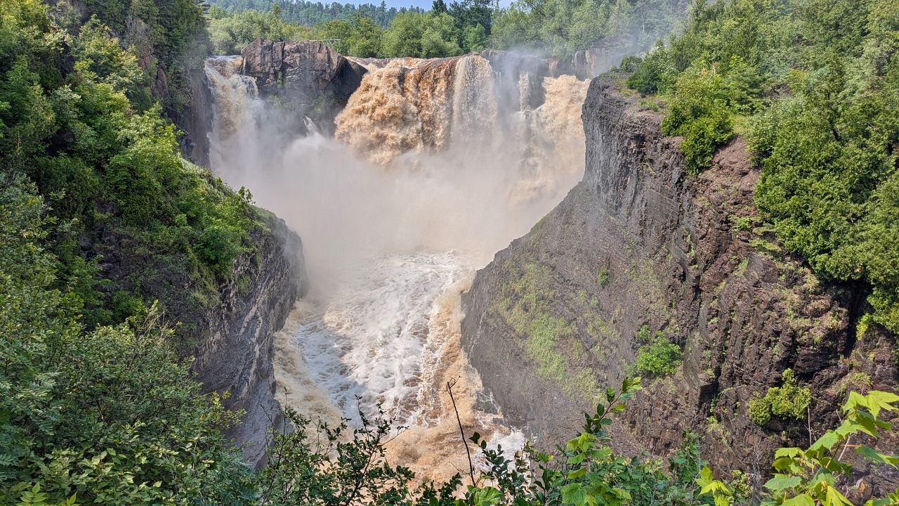
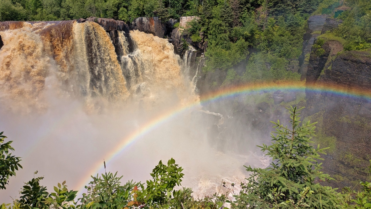
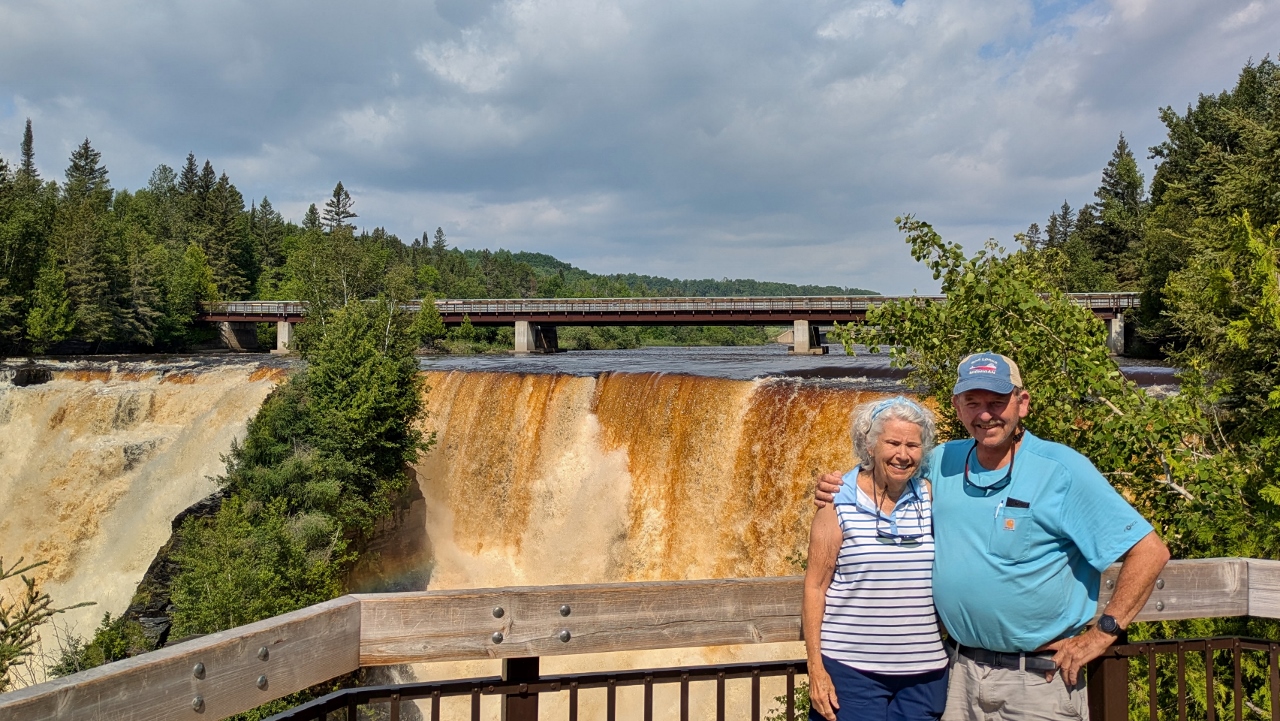
On to our last stop before crossing into Canada, the falls on the Pigeon River that made the Grand Portage necessary. We learned that the flow rate over the falls was at a record high for this time of year. About half a mile in we heard the roar get louder and, turning a corner in the trail, we were there. Wow! You can view the falls from several platforms and we went to all of them. The platform at the top, yeah, more stair steps, was especially cool because the sun and heavy spray created a persistent rainbow. And, we now understand more fully the need for the portage.
Our border crossing was uneventful and we continued on our way into the area known as the bread basket of northwestern Ontario with miles of grain fields surrounded by the rugged mesas of the Sawtooth Mountains. Arriving at our city-owned campground, Chippewa Park on the west end of Thunder Bay, we plugged in so we could run our air conditioning, something we rarely needed to do on this trip.
Then it was relaxation time with wine and beer until dinner time. We used up most of our remaining stores to make a meal of sautéed shrimp with broccoli and mushrooms. Time to go grocery shopping!
2025-07-25 – Thunder Bay, ON
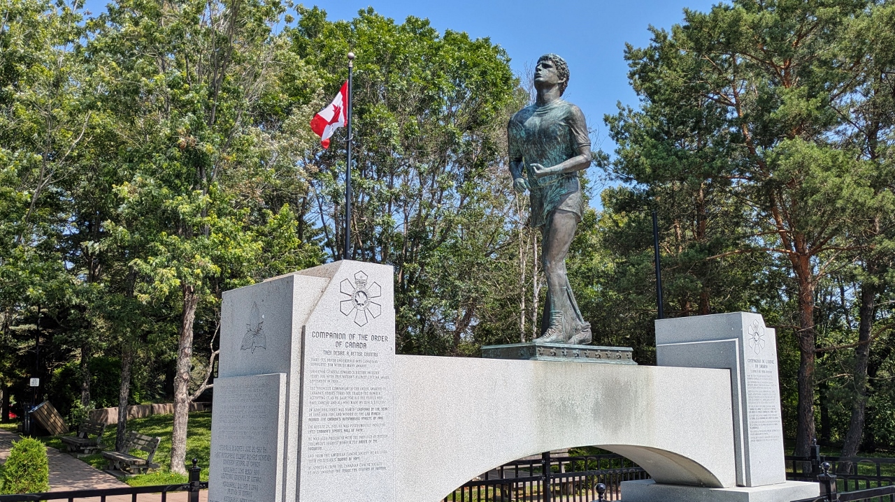
We drove to the far side of the city to visit the site of the Terry Fox National Historic Person Plaque. The roadside stop and visitor center provides a great overview of Lake Superior and our next stop, the Sleeping Giant. The small park honors Terry Fox, the courageous runner who, after losing his leg to cancer at age 18, ran his “Marathon of Hope”, a cross-country run in support of cancer research. Terry ran the equivalent of a full marathon every day until he was forced to end his run after 3,339 miles when his cancer returned. Sadly, he died only nine months later.
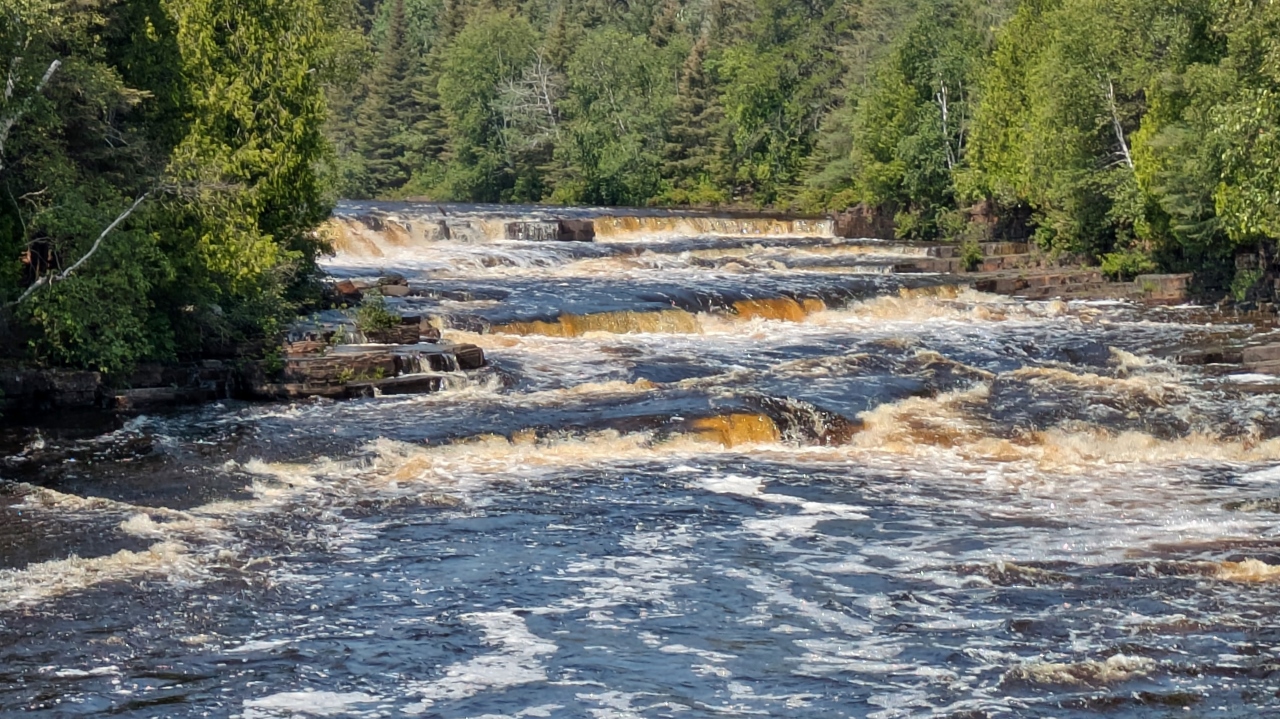
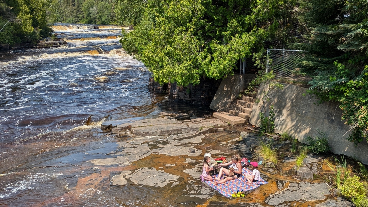
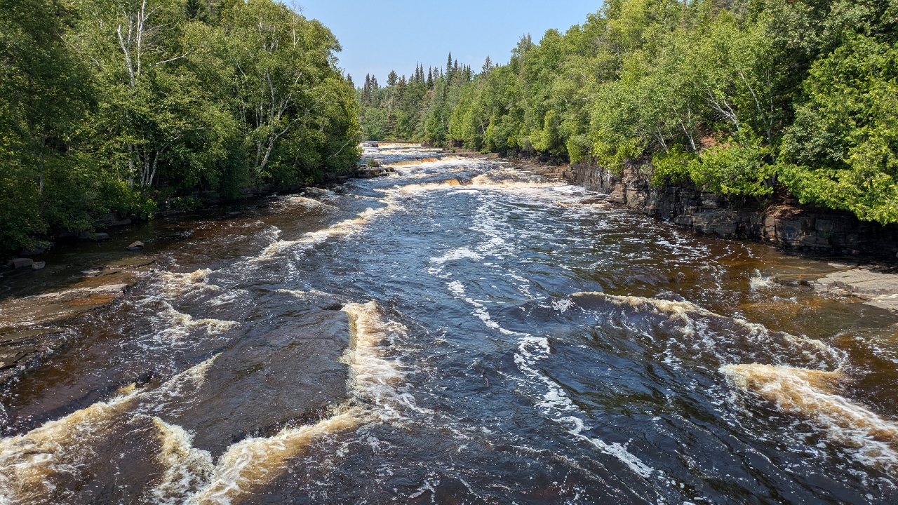
The Current River is a fast moving stream that transforms into a series of wide, low cascades called Trowbridge Falls. It’s an interesting place with flat rock shoreline where families can lounge at water’s edge just below the last cascade.
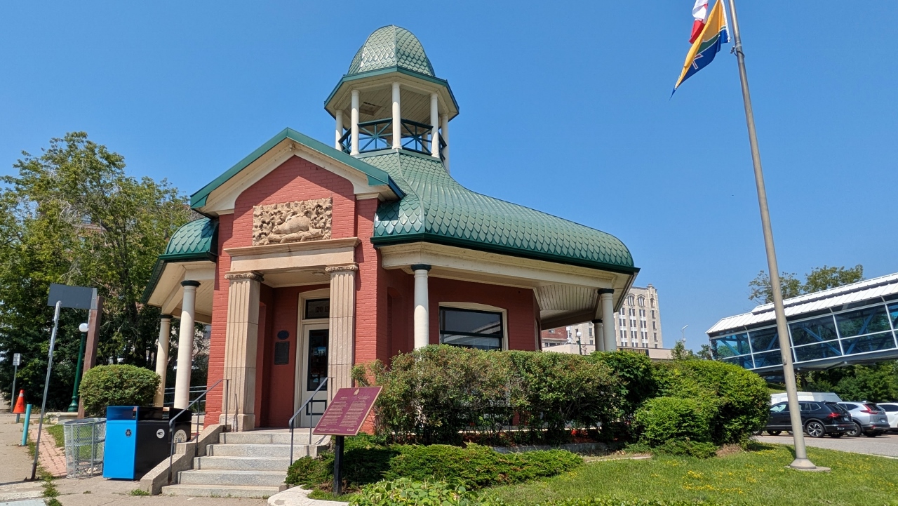
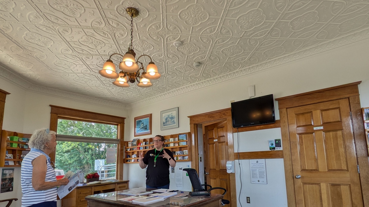
The oldest visitor center in Thunder Bay is the Tourist Pagoda and, yes, it is a small pagoda near the downtown waterfront area.
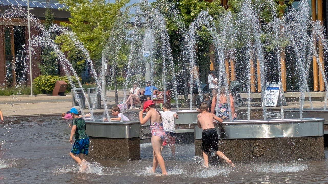
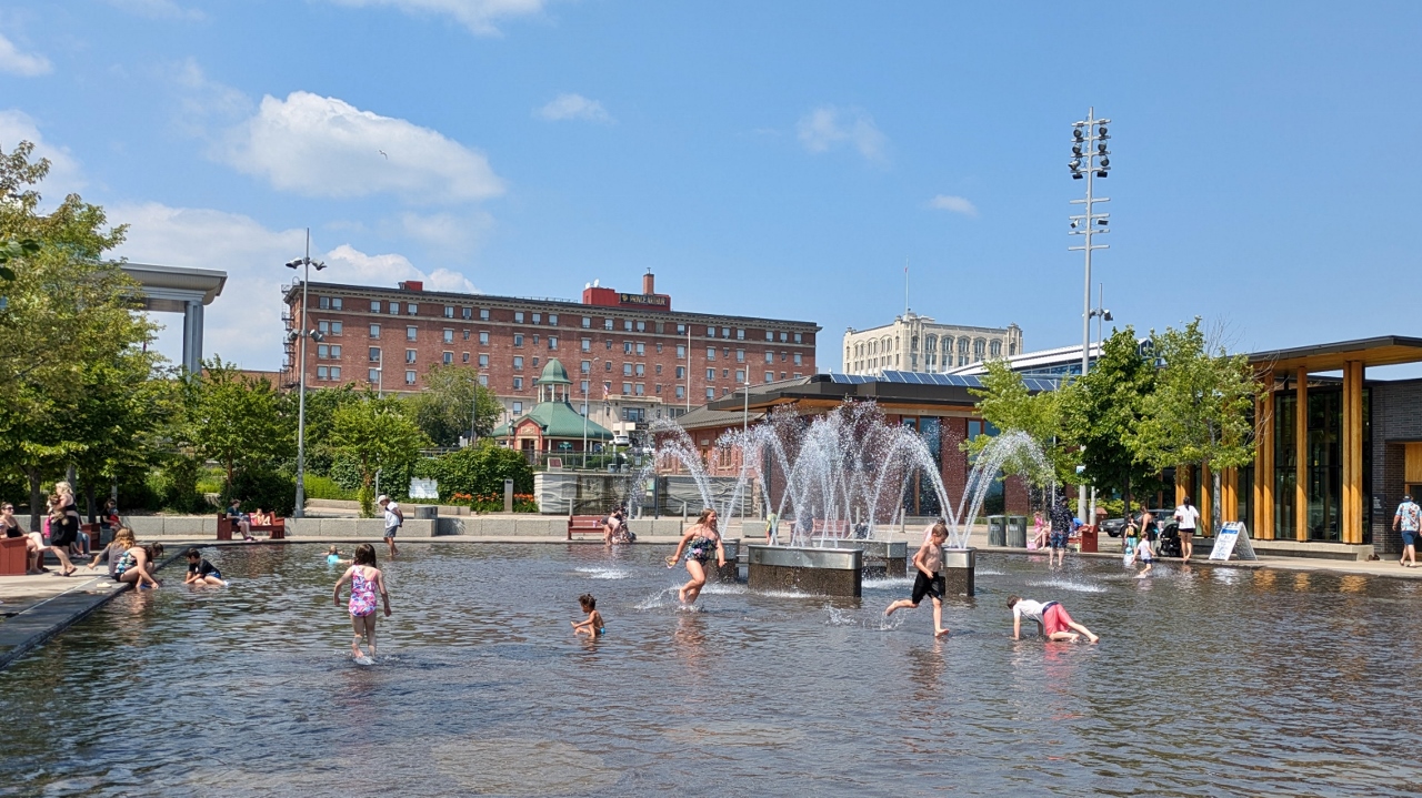
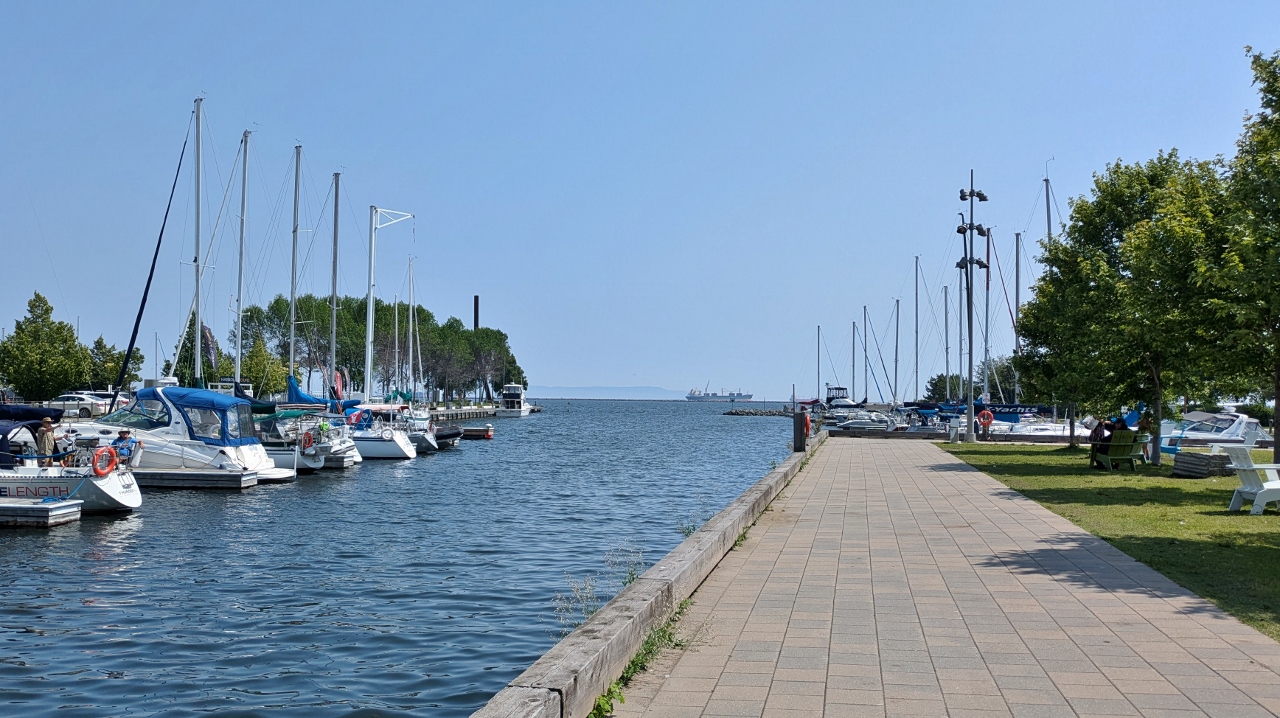
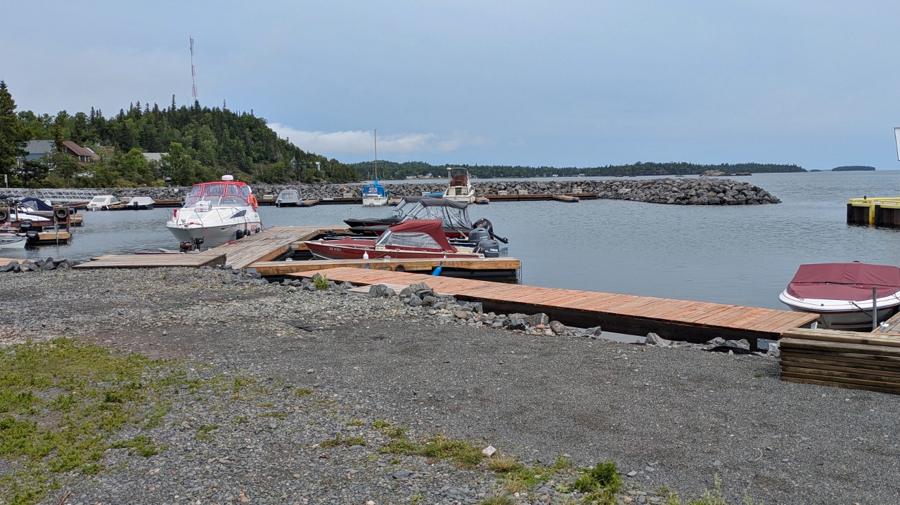
Speaking of waterfront, the city’s Marina Park and waterfront district is adjacent to a sizeable marina. The highlight of the place is a large splash pad/fountain where families, especially the kids, can cool down during hot weather. The place was crowded when we visited. We’d expected a vibrant shopping district in the area. The large train station had reportedly been renovated with shops but that idea apparently hadn’t succeeded with only a coffee place and a boutique operating in the building.
Dinner was burgers with corn on the cob and sliced tomatoes. A summertime treat!
2025-07-26 – Thunder Bay, ON
With only about ten percent remaining of our forty pound propane supply, we needed a refill before setting off across the thinly populated north shore of Lake Superior. We found it at Canadian Tire in town, a multi-tasking tire store chain that, besides selling tires and propane also has a garden center.
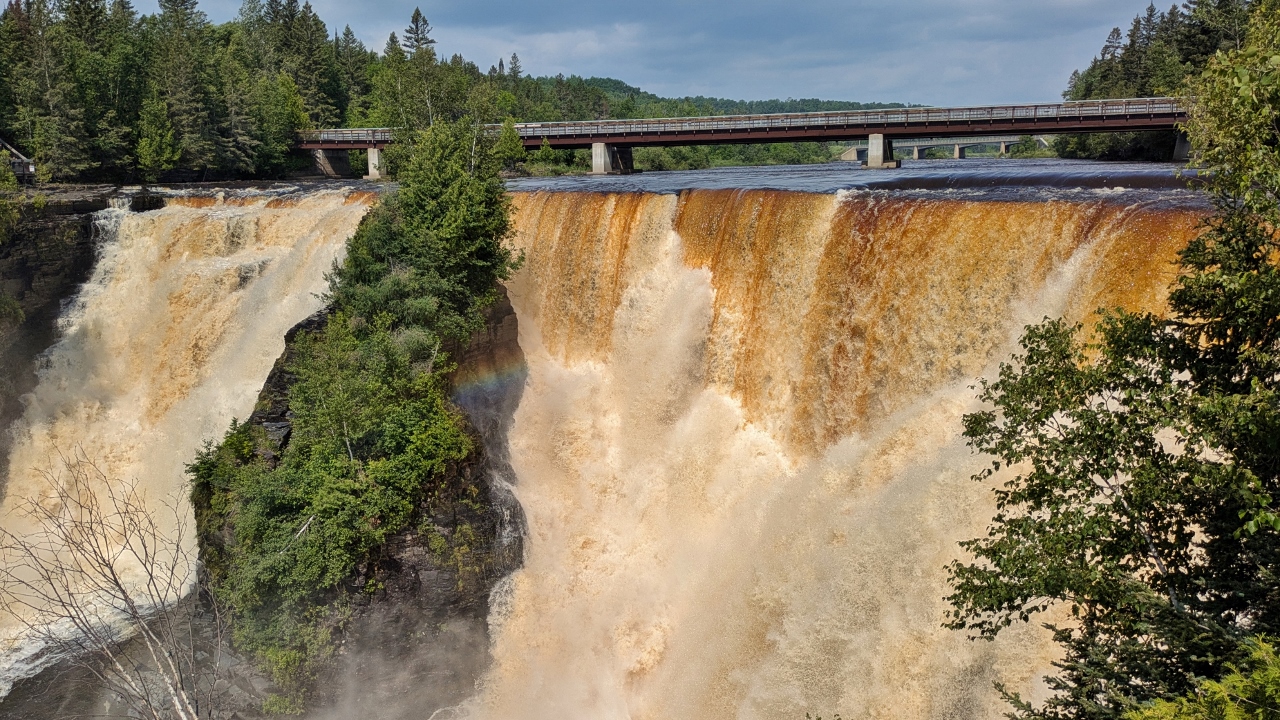
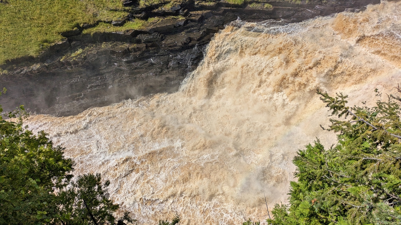
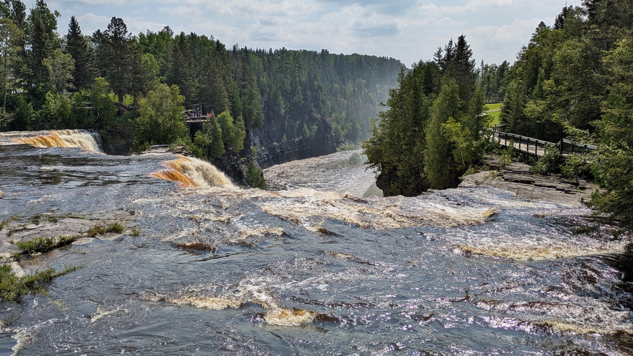
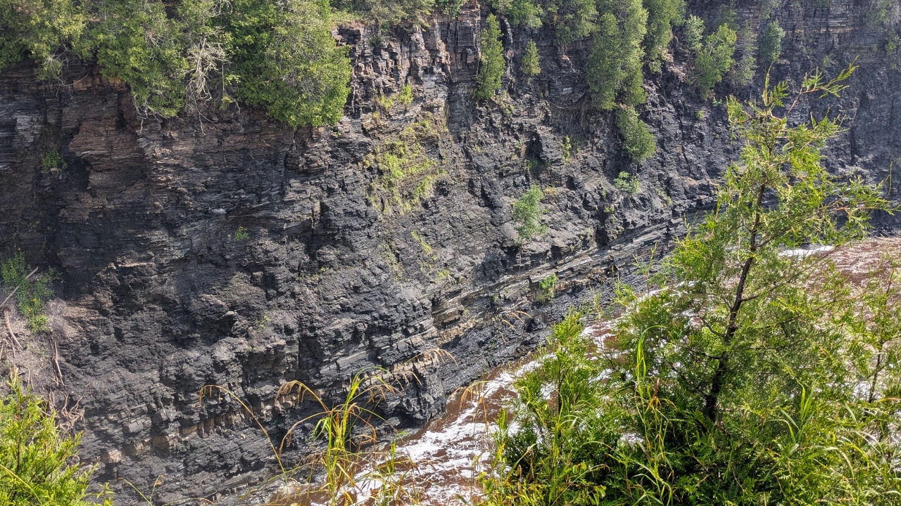
Kakabeka Falls was recommended by many so we set off to see it. Well, the recommenders were right! “The Niagara of the North” is a falls on the Kaministiquia River. It’s single cascade is 130 feet high and it is very large. There is a highway bridge that crosses it near the top and visitors get to view it from both sides on boardwalks. It was loud and magnificent. We also walked a loop trail along the river for a couple more views of the falls and the canyon.

2025-07-27 – Sleeping Giant Provincial Park
Sleeping Giant Provincial Park covers most of the long, Sibley Peninsula across the harbor from Thunder Bay. Since people spoke highly of it, we just had to check it out. Besides, silver had been mined on a tiny island off its south end.
We moved to the park’s campground, Marie Louise Lake Campground, near its southern end. As the name implies, the campground is actually sited on a lake inside the park rather than on the shores of Lake Superior.
Sleeping Giant is mostly about the relatively long, mostly rugged hiking trails that thread among the dramatic geologic features of the park, not hiking that we were particularly interested in during our one day there. The weather was heavy overcast and very wet & muddy from the heavy rain.
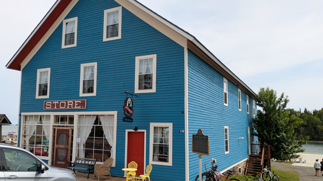
We did drive to a tiny settlement of Silver Islet near its southern tip. From there you can gaze at Silver Islet, the small island that was the site of the largest silver mine in the world! A vein of nearly pure silver was discovered on the island in 1868. Because the island was so small and low to the water, dikes were built around it for protection from waves and it was expanded to make room for mine buildings.
The mine operated successfully for sixteen years until the price of silver started to decline and a delivery of coal, necessary to run the mine’s dewatering pumps, failed to arrive before the end of shipping season. So, the 1,200 foot deep mine flooded when the pumps failed. The mine was never reopened. There’s not much to see there, just a barren bit of rock offshore and a couple of signs on the settlement’s harbor.
There is a general store on the harbor. Built in 1871, it is an historical landmark of this tiny mining community. The museum features a few artifacts from the original silver mine along with signage that documents the people and events of the time. Today the settlement mostly consists of seasonal vacation homes.
There isn’t really much tour in the park but we did drive the eight mile, one-way gravel road that circled the lake hoping for some pretty views. There weren’t any views but there were a number of really nice rustic lakeside campsites along the road.
We used some of our vermicelli rice noodles in a chicken and veggie stir fry for dinner.