2025-09-01 – Pulpit Rock Campground, IA
Leaving Scenic View Campground we had to, once again, make the long drive on that dusty, gravel road. Fortunately, on our way Scenic View we’d noticed a car wash with a high bay that our camper could fit into. So we made a stop there and gave both the camper and the car much needed washings.
Carol and Nixon recommended a couple of stops that we could take in before heading to our next campground.
The first was Pikes Peak; no, not the one in Colorado. This one is on the banks of the Mississippi in Iowa. Both peaks were named in honor of the same guy, Zebulon Montgomery Pike, who identified both of them. The main feature of the Iowa peak, located in Pikes Peak State Park, is a magnificent, 500 foot high overlook that peers down at the area where the Wisconsin River flows into the Mississippi from the east.


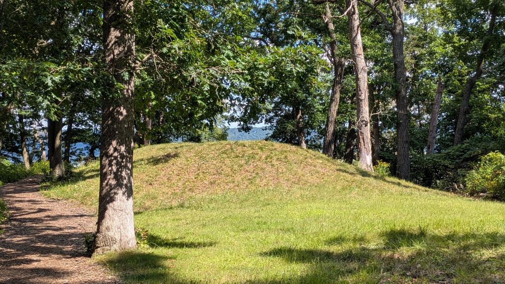
We also walked a short trail that lead to an Indian mound.

Also featured in the park is Bridal Veil Falls. Part of the trail to the falls is a boardwalk but much of that is stairs and Bill opted out. So, while Bill nestled down to read his book in the shade, Sandy climbed the 248 stair steps to the falls. Although the falls were pretty, only a small trickle of water was flowing.


Seven miles north of Pike’s Peak is the Effigy Mounds National Monument. Considered sacred by many culturally associated American Indian tribes, similar mounds are scattered across the United States, almost all of them east of the Mississippi. Archaeological excavations of some of them have revealed that they are burial sites.


This area was chosen as a national monument because many mounds are grouped near to each other and many of them are effigy mounds. While most mounds are single mounds of varying sizes, effigy mounds are multiple mounds linked together into groups, some of which resembling living things. We climbed the two mile trail to see them and to peer over a couple of overlooks.
The most notable effigy mound we saw was Little Bear Mound Group which, indeed, looked like it represented a bear. We also passed a large compound mound where four mounds were linked together. There were also a couple of great overlooks along the trail.


As we continued west after leaving Effigy Mounds the land got flatter and flatter, the fields of corn and beans got larger and the storage silos more numerous. Also, we began to notice large feed lots for cattle and hogs.
The city of Decorah, IA, was to be our next stop on our way west. The city has its own campground where we’d made a two-night reservation. Dinner that evening was a Mediterranean style dish of chicken with cannellini beans, sun dried tomatoes and green olives. Pretty tasty!
2025-09-02 – Pulpit Rock Campground, IA
We spent the morning doing chores. Bill’s was to post a couple of blog episodes. Since we had no internet connectivity at the campground, Bill went to a nearby MacDonald’s to take advantage of their fast, free WiFi.
The Chuck Gipp Decorah Fish Hatchery lies a few miles south of the city. Built by the CCC, today the hatchery has 24 cement flow-through raceways. There are also three rubber lined earthen ponds that provide a habitat for their brood stock. The hatchery releases about 130,000 catchable fish, mainly rainbow trout each year. It’s an interesting place.


Water for the hatchery comes from the large Siewers Springs emerging from a rocky outcrop right on the property. The water flows through a park-like area and people are welcome to picnic as well as fish the stream.


With imminent rain threatening, we chose to check out the downtown area rather than taking a hike. Dinner was burgers with corn on the cob and sliced tomato given to us at a previous campground. Delicious!