2026-06-29 – Grand Marais & Pictured Rocks
We’re inching our way west, again, along the southern coast of Lake Superior. Our destination is the small town of Grand Marais, population 1,300, at the eastern end of Pictured Rocks National Seashore. Woodland Park Campground is actually part of a municipal park. It is right in town and is nicely set up with fairly new, well maintained restrooms and grassy sites.
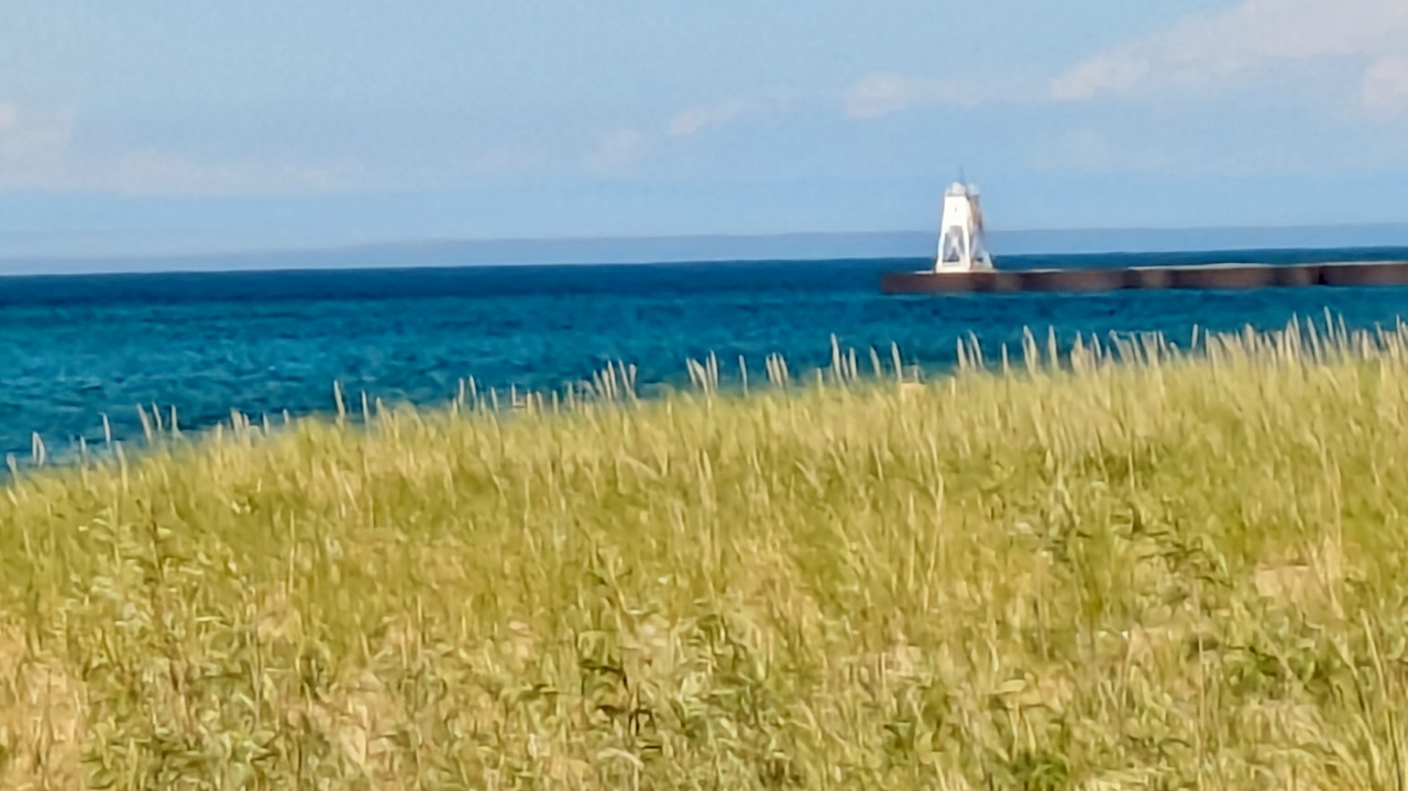
We didn’t have any agenda for the day so we simply drove around to get the lay of the land. There is a very nice but mostly undeveloped harbor protected by a large breakwater. The municipal marina is small. The downtown is compact but features several restaurants, two small groceries, and a hardware store as well as an outfitter. There are, of course, several gift shops and even a gallery. And every place offers tees, sweats and other Grand Marais and Lake Superior themed stuff. In all, it’s a nice, small town.
Burgers with sautéed mushrooms and asparagus for dinner. Then it rained much of the night.
2026-06-30 – Pictured Rocks National Seashore
Pictured Rocks National Seashore is 42 miles long, stretching along Superior’s southern shore from Grand Marais on the east to Munising on the west. Most of the area is only accessible to hikers with only a couple of features you can drive to at the east end of the park.
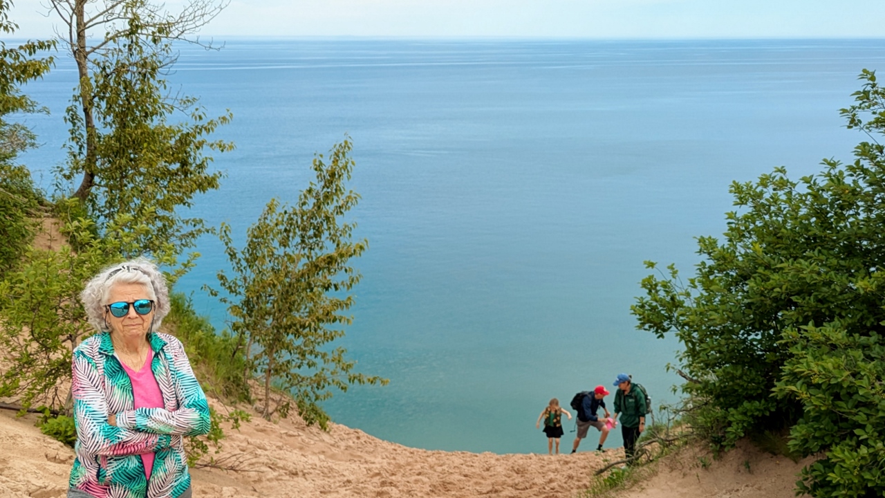
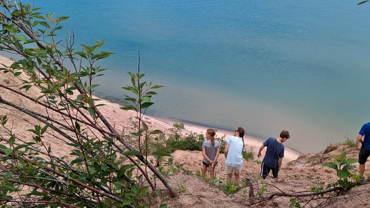
After stopping at the Grand Sable Visitor Center, we headed for the Log Slide Overlook on the Grand Sable Dunes. Lumbermen who timbered the area needed to get their harvest into the lake to move it to sawmills. Since the edge of the dunes on which they were working were about 175 feet above the lake, they simply slid the logs down the dune to the water on a chute they constructed.
A short walk takes you past some exhibits to the edge of the dune for a look down to the water below. It’s an arresting sight. Signs seriously caution visitors against sliding down to the water. The trip down takes only a few harrowing seconds but the challenging trudge back up the face of the dune can take more than an hour.
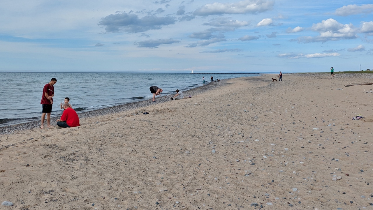
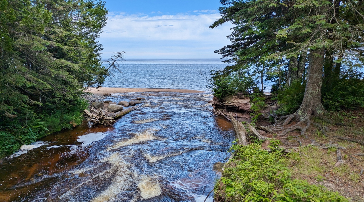
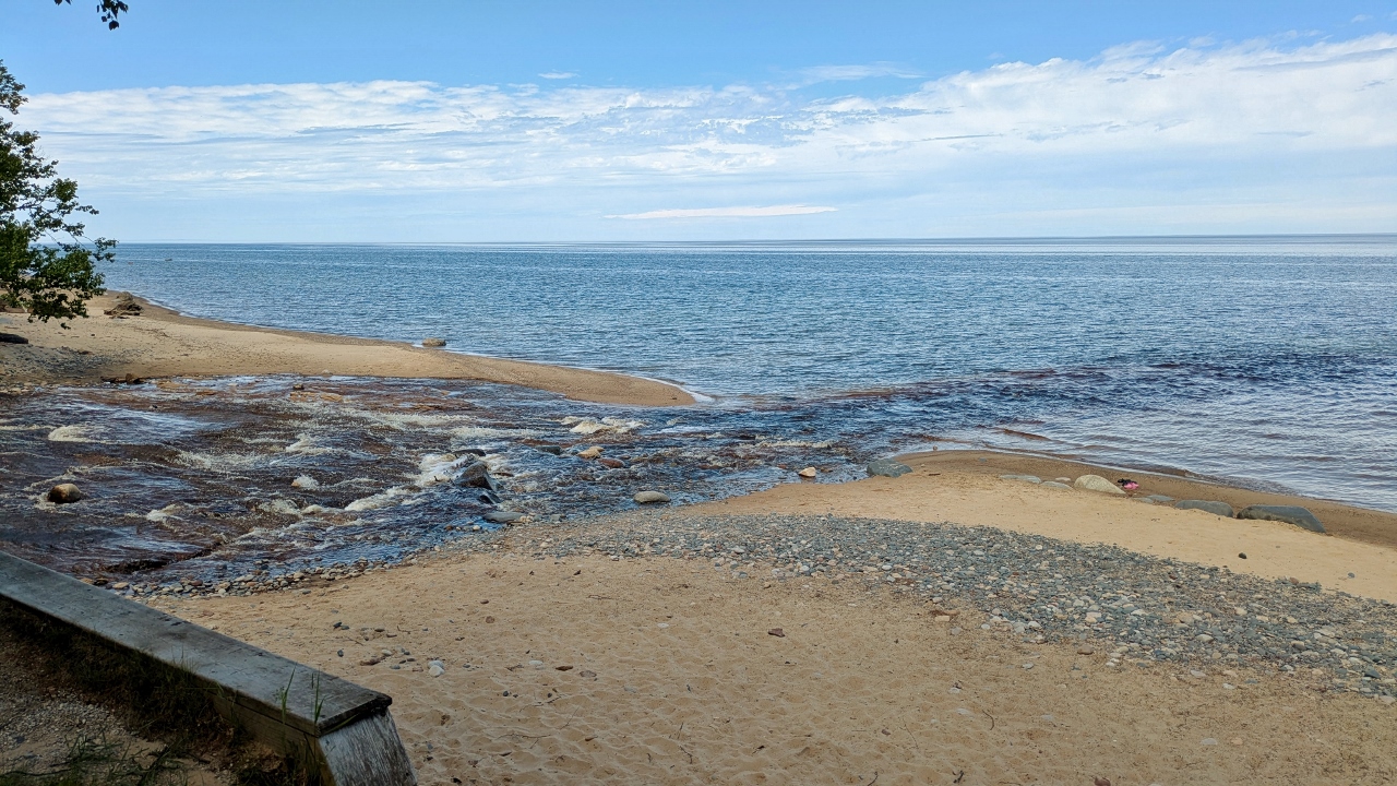
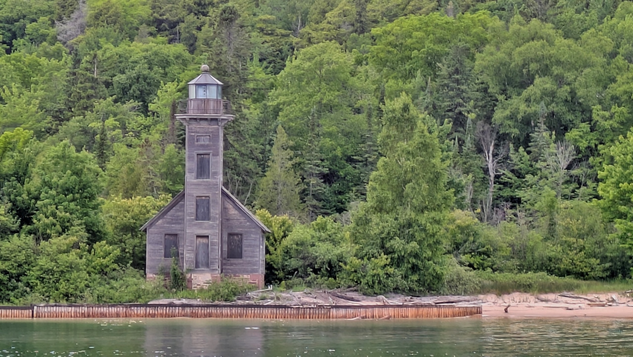
Next on the list was the Ausable Point Lighthouse Trailhead at the mouth of the Hurricane River. The tannin colored river is pretty as it splashes down the last few hundred feet across flat rocks into the lake. Tannin has colored the rock over the years and it’s a cool sight from the small picnic area above the beach.
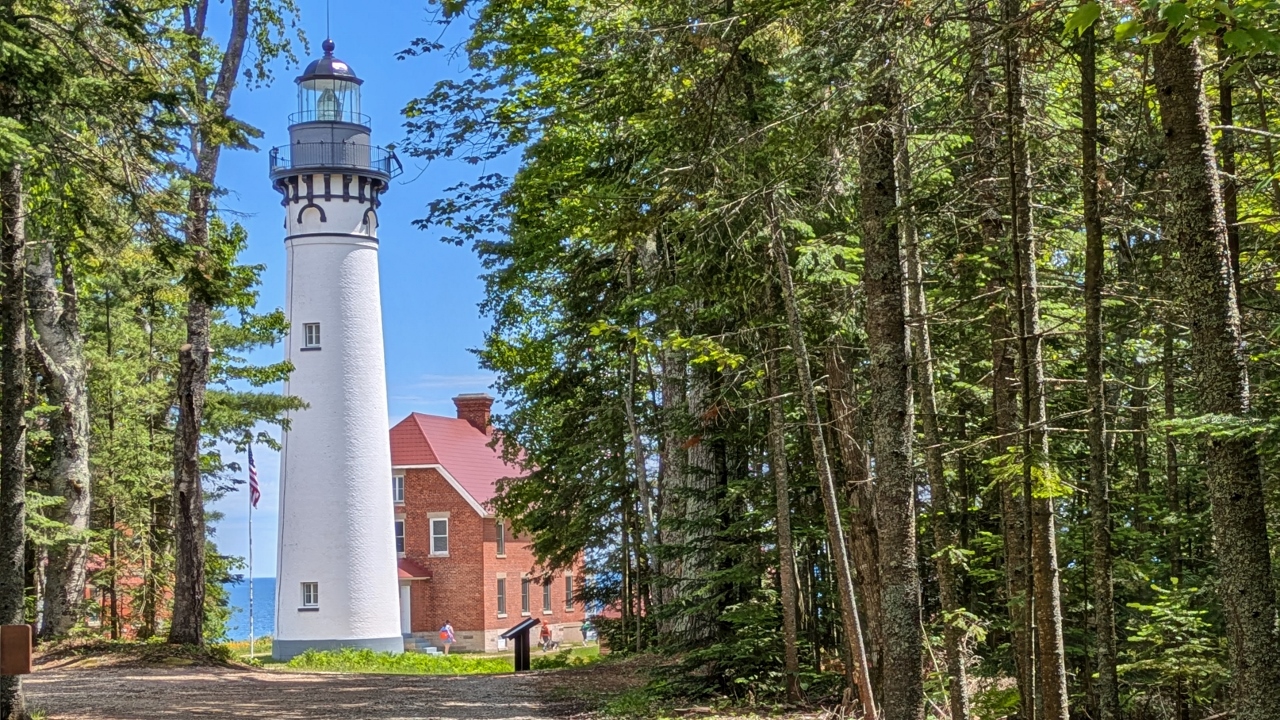
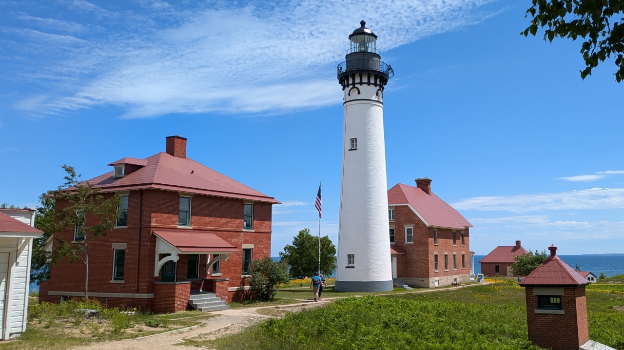
We took the 3½ mile out and back trail to the lighthouse. The trail was very easy, flat and wide of hard packed gravel. The only annoying part were the mosquitoes that harassed us along the way. A heavier application of Deep Woods spray solved that problem.
The walk was well worth our time. Ausable Point Lighthouse has got to be one of the prettiest lights we’ve seen. Unfortunately, we weren’t able to climb the light because we’d have had to wait more that an hour until the next tour.
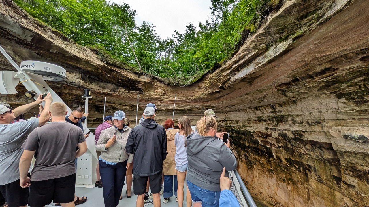
So, on to the day’s pièce de résistance, a cruise along the famed Pictured Rocks. You get the cruise in Munising at the west end of the park, nearly an hour’s drive from where we were. When we got there we went directly to the Pictured Rocks Cruises, LLC and purchased tickets for the 4:00 cruise.
People start lining up nearly an hour before departure so they can get their pick of seats. They actually have seating arranged in a queue so that people are seated in the order they arrive and, subsequently, board. We got prime seating on the starboard side of the top deck where we’d get the best views while outbound. The boat, which could seat about 300 people, was no more than half full so good seats weren’t really a problem. The boat, a catamaran, cruised out to the rocks at 30 knots. Since it was cloudy and cool, we were happy to be in long pants with long sleeved tops to ward off the wind-driven chill.
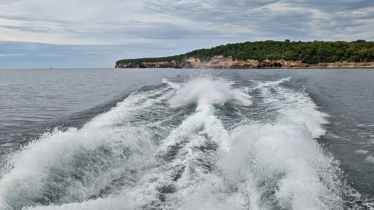
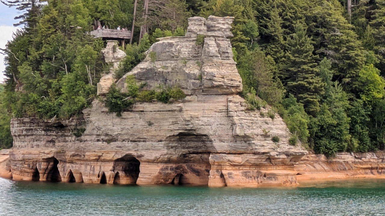
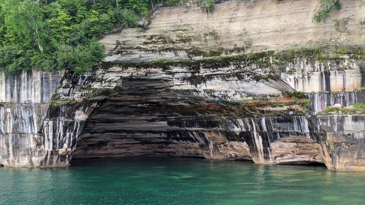
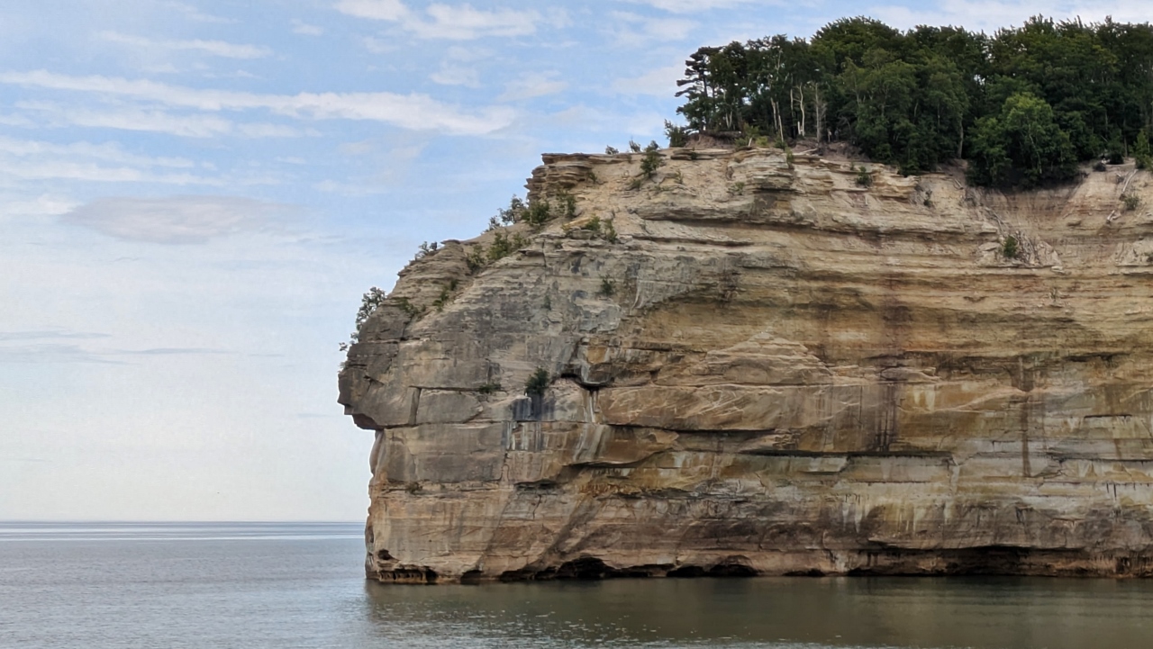
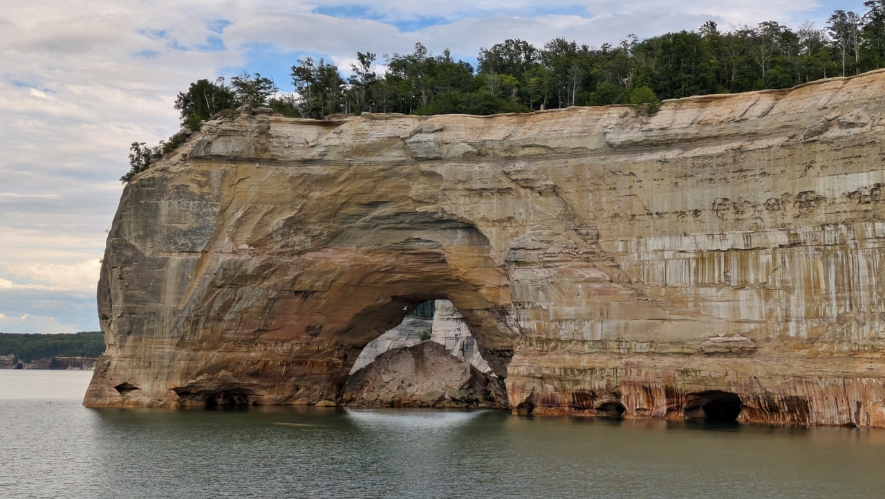
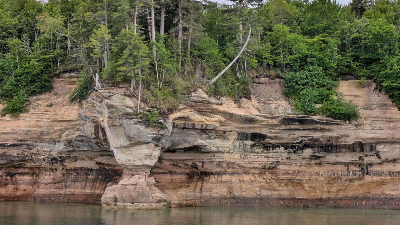
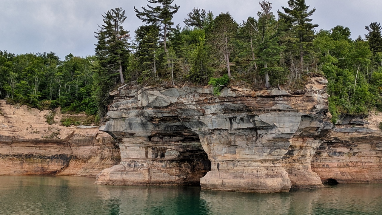
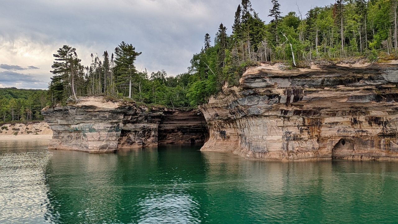
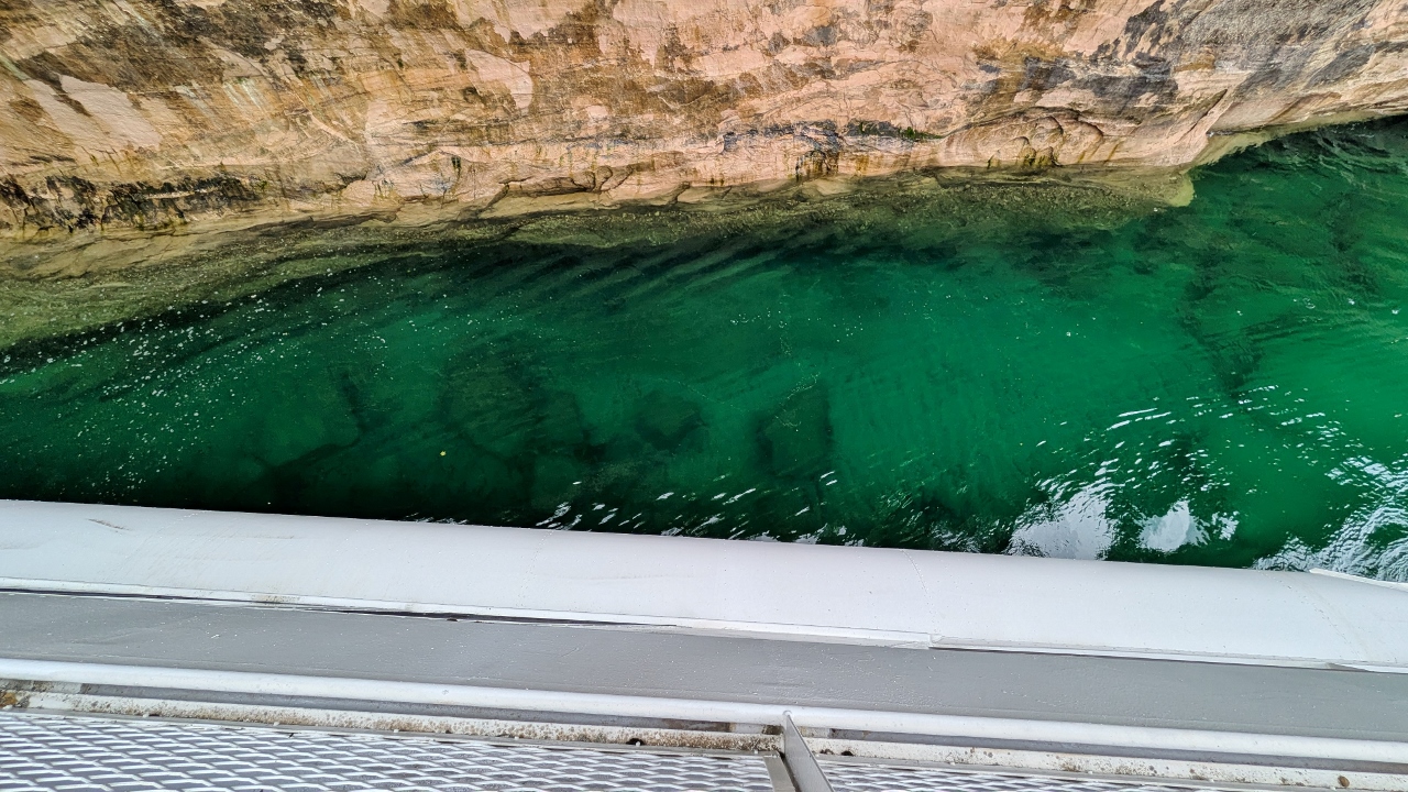
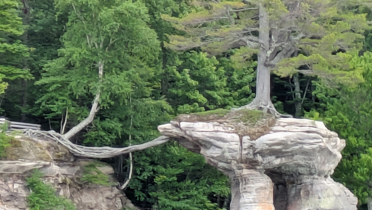
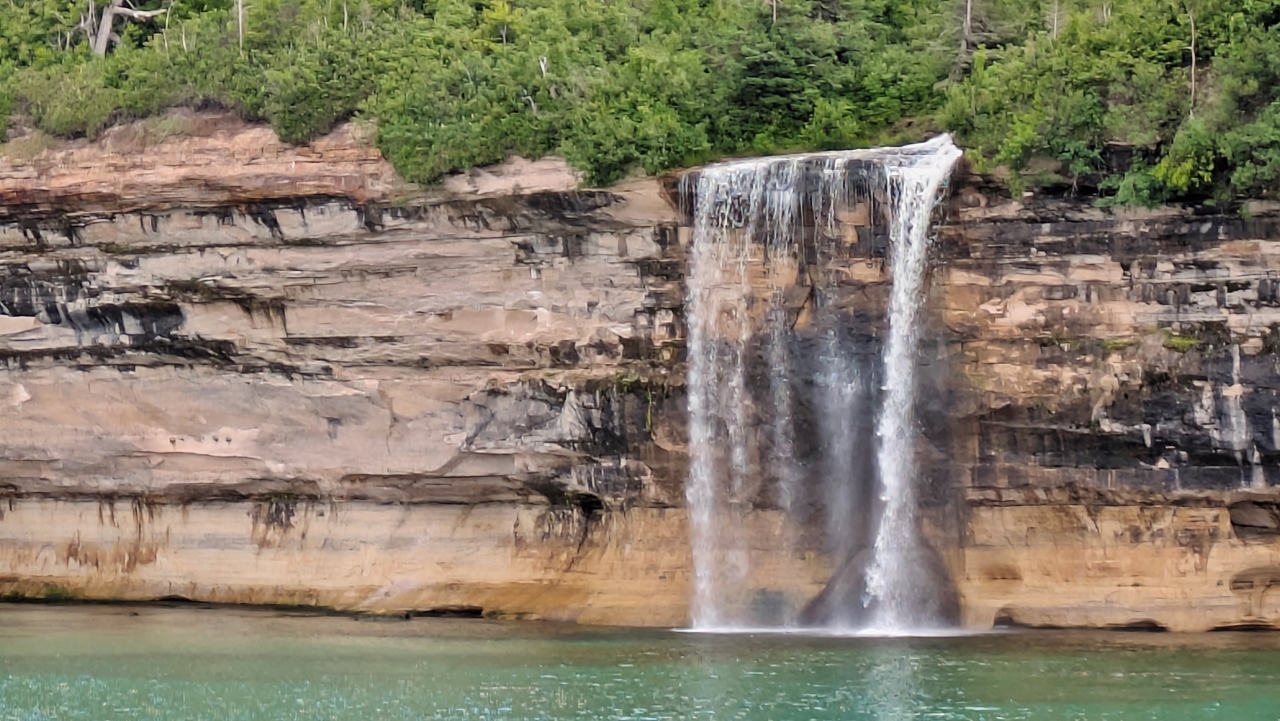
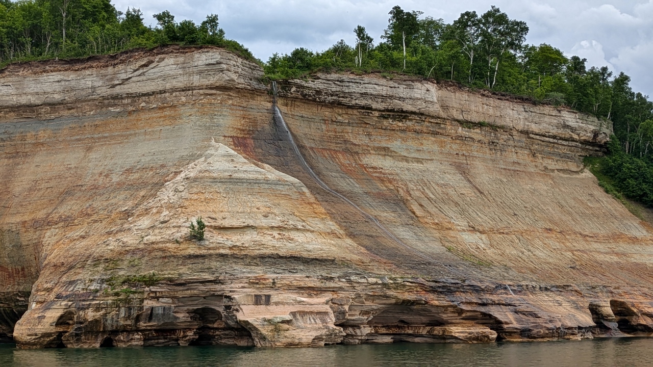
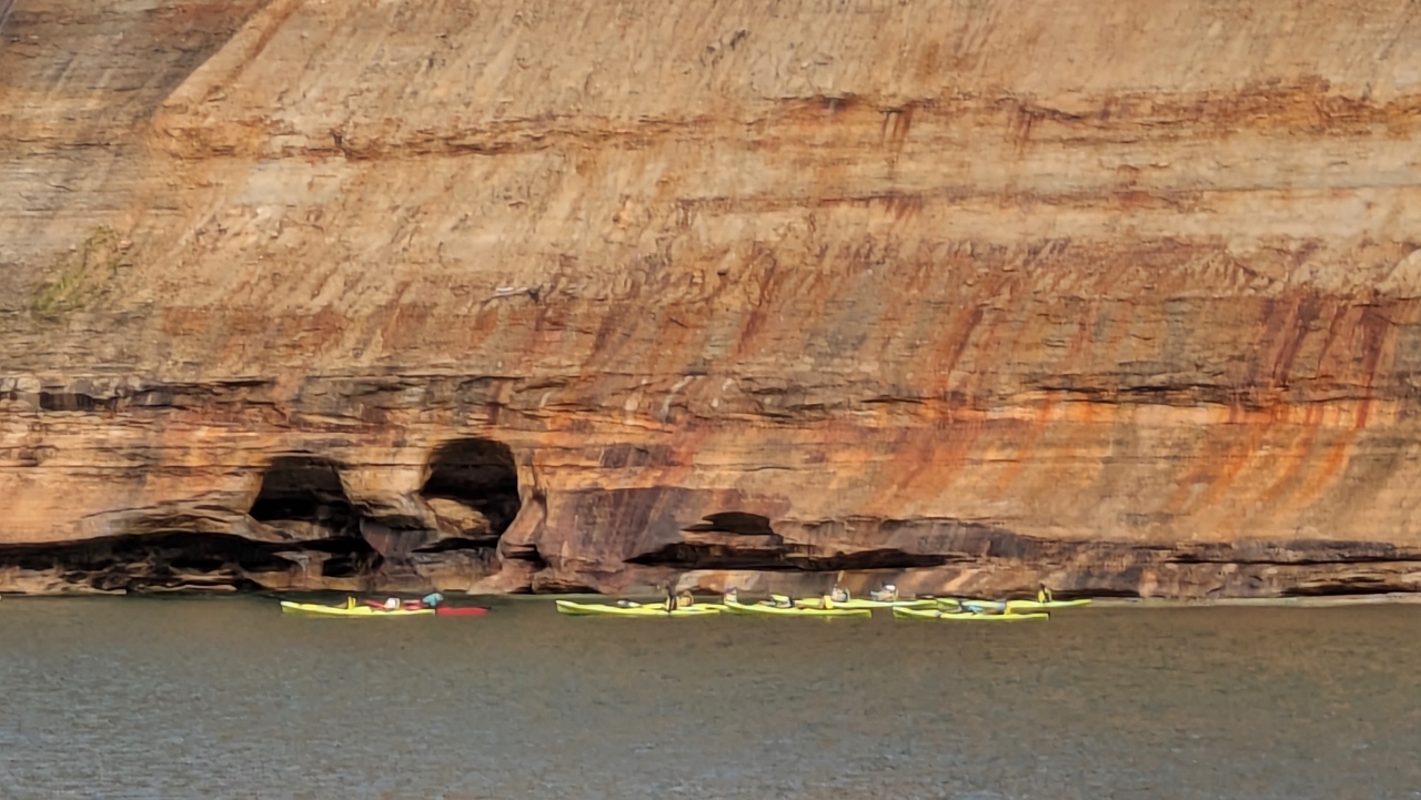
The “rocks” are miles of 200 foot high sandstone cliffs that line the lake in this area. They have been eroded into fanciful shapes by wave action. Since they are sedimentary, the faces are striated horizontally according to the type of mud that turned into sandstone during each era of development. Then water, either pouring from the top, or seeping out through the layers, carries minerals that stain the rocks vertically. The total effect of erosion combined with horizontal and vertical color bands is striking. Best seen in clear weather in the late afternoon, our conditions weren’t ideal because it was cloudy. Nevertheless, the scene was way cool.

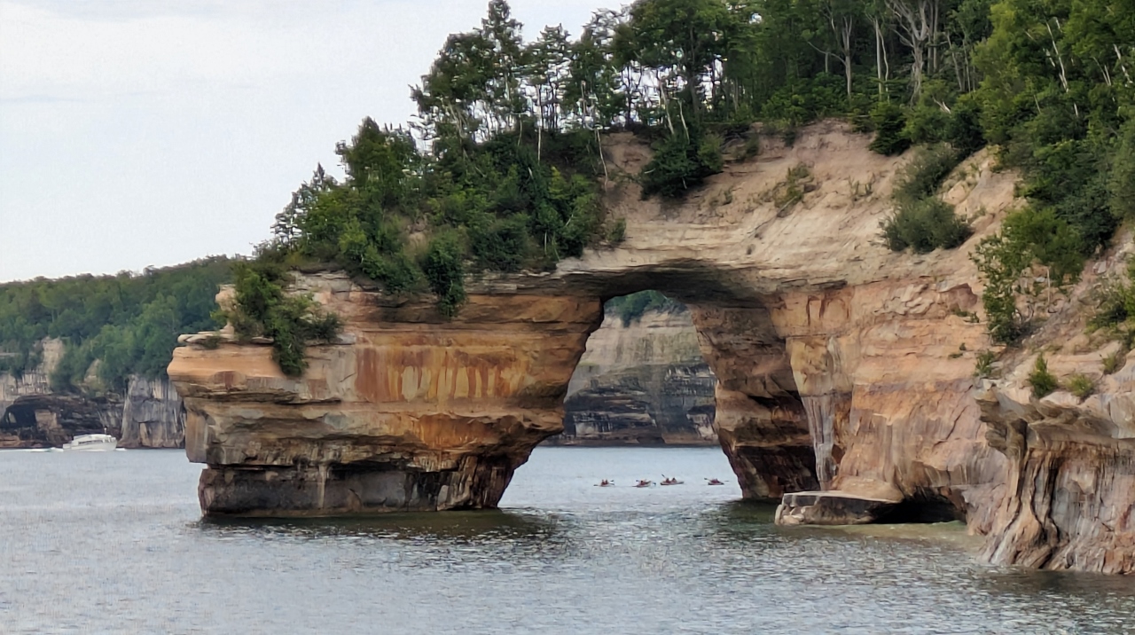
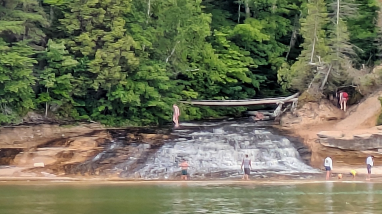
We were struck by the huge number of people we saw kayaking under the cliffs. “How,” we wondered, “did they get there?” The answer was a flotilla of commercial “mother” boats who provide the kayaks and drop off their clients near the area they paddle. Sounds like a neat idea for our next visit!
When we disembarked at 6:00 we still faced more than an hour’s drive back to Grand Marais. There being no restaurants along the way, dinner, we decided, would happen in Munising. We chose The Dogpatch Restaurant, a Li’l Abner themed place that made a mean chefs salad. (We assume our readers remember Li’l Abner since they didn’t stop publishing the comic strip until 1977.)